IMAGES TAKEN NEAR TO
Boverton, LLANTWIT MAJOR, CF61 1UB
Introduction
This page details the photographs taken nearby to CF61 1UB by members of the Geograph project.
The Geograph project started in 2005 with the aim of publishing, organising and preserving representative images for every square kilometre of Great Britain, Ireland and the Isle of Man.

There are currently over 7.5m images from over14,400 individuals and you can help contribute to the project by visiting https://www.geograph.org.uk
Image Map
Images are licensed for reuse under creativecommons.org/licenses/by-sa/2.0
Notes
- Clicking on the map will re-center to the selected point.
- The higher the marker number, the further away the image location is from the centre of the postcode.
Image Listing (4 Images Found)
Images are licensed for reuse under creativecommons.org/licenses/by-sa/2.0
Image
Details
Distance
1
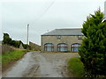
Approaching Boverton Mill Farm
The lane carries on past the farm and reaches Summerhouse Point, very nearly the most southerly point in Wales.
Image: © Jonathan Billinger
Taken: 23 Mar 2010
0.01 miles
2
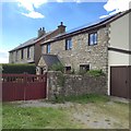
Boverton Mill Farm
Cottages at Boverton Mill Farm.
Image: © Alan Hughes
Taken: 13 Jul 2016
0.02 miles
3
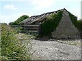
Old Barn, Llantwit Major
One of only two remaining after considerable development of old adjacent farm buildings
Image: © Mick Lobb
Taken: 22 Jun 2008
0.05 miles