
IMAGES TAKEN NEAR TO
Station Road, LLANTWIT MAJOR, CF61 1ST
Introduction
This page details the photographs taken nearby to Station Road, CF61 1ST by members of the Geograph project.
The Geograph project started in 2005 with the aim of publishing, organising and preserving representative images for every square kilometre of Great Britain, Ireland and the Isle of Man.

There are currently over 7.5m images from over14,400 individuals and you can help contribute to the project by visiting https://www.geograph.org.uk
Image Map
Images are licensed for reuse under creativecommons.org/licenses/by-sa/2.0
Notes
- Clicking on the map will re-center to the selected point.
- The higher the marker number, the further away the image location is from the centre of the postcode.
Image Listing (479 Images Found)
Images are licensed for reuse under creativecommons.org/licenses/by-sa/2.0
Image
Details
Distance
1

School entrance, Llantwit Major
Names in view on the corner of Station Road include
St Illtyd Primary School & Nursery Unit
St Illtyd's Family Centre
Western Vale Integrated Children's Centre.
Image: © Jaggery
Taken: 3 Apr 2015
0.00 miles
2
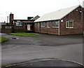
Llantwit Major Youth Centre
Located on the north side of Station Road, near the entrance to St Illtyd Primary School.
The Vale of Glamorgan Council website states that the Youth Centre is for young people ages 11-25.
Image: © Jaggery
Taken: 3 Apr 2015
0.02 miles
3

Llantwit Major telephone exchange
On the south side of Station Road.
Image: © Jaggery
Taken: 3 Apr 2015
0.03 miles
4

Lorna Hughes Park, Llantwit Major
A small park established in memory of a local dignitary.
Image: © Mick Lobb
Taken: 9 Jan 2009
0.03 miles
5
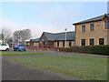
WVICC, Llantwit Major
The Western Vale Integrated Children's Centre caters for four core themes – early years education, childcare, open access play, and training and community development and provides a wide variety of facilities and courses for various groups and organisations.
These include Sunshine Group, Stay and Play, Parent and Toddler, Childminders' Support Group, Credit Union, Clap, Tap and Rhyme, Fruit and Veg Community Co-operative.
Image: © Mick Lobb
Taken: 9 Jan 2009
0.03 miles
6

Stag Lane, Llantwit Major
This otherwise nondescript side street in the town centre is of interest for its unusual name sign. http://www.geograph.org.uk/photo/3177527
Image: © Jaggery
Taken: 9 Jul 2011
0.04 miles
8

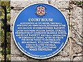
Corner of Station Road and Durell Street, Llantwit Major
The nameboard showing BETHEL BAPTIST CHURCH is in front of the church's eastern edge.
http://www.geograph.org.uk/photo/3177530 to a view of the west side of the church.
Image: © Jaggery
Taken: 3 Apr 2015
0.05 miles
9

Bethel Baptist Church, Llantwit Major
Located on the corner of Station Road and Commercial Street, one of the narrow town centre streets where a one-way traffic system operates. The church building dates from 1830. The first sermon preached here was given by the famous one-eyed preacher Christmas Evans.
Image: © Jaggery
Taken: 9 Jul 2011
0.05 miles
10

No parking - Royal Mail access only, Llantwit Major
The notice is on a gate at the entrance to a yard on the north side of Station Road.
Image: © Jaggery
Taken: 3 Apr 2015
0.05 miles