1
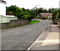
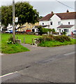
Towards a bend in Eagleswell Road, Boverton
This way for Llantwit Major in the Vale of Glamorgan.
Image: © Jaggery
Taken: 25 Sep 2019
0.05 miles
2
Road closed for Bridge replacement - Llantwit Major
The 114 year old railway bridge being replaced at Eagleswell Road at a cost of £700,000. It is estimated that the replacement will not require any further attention for 25 years and should last 125 years so I won't see the next one!
Image: © Mick Lobb
Taken: 19 Nov 2010
0.07 miles
3
Percy Smith Road, Boverton
From the east side of Eagleswell Road, Percy Smith Road leads to Harding Close, Glanymor and Gaskell Close.
Image: © Jaggery
Taken: 25 Sep 2019
0.08 miles
4
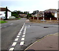
Junction of Percy Smith Road and Eagleswell Road, Boverton
From the right, Percy Smith Road joins Eagleswell Road. Ahead for Llantwit Major.
Image: © Jaggery
Taken: 25 Sep 2019
0.08 miles
5
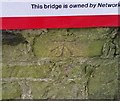
Ordnance Survey Cut Mark
This OS cut mark can be found on the SW side of the railway bridge. It marks a point 38.569m above mean sea level.
Image: © Adrian Dust
Taken: 11 Mar 2018
0.08 miles
6
South side of Eagleswell Road railway bridge, Boverton
The Vale of Glamorgan Line is on the bridge, identifier VOG 9 04.5
Headroom shown is 4.3 metres/14' 0".
Image: © Jaggery
Taken: 25 Sep 2019
0.08 miles
7
Eagleswell Road bus stop opposite Percy Smith Road, Boverton
This is a stop on bus route 303 from Barry to Bridgend, in September 2019 operated by NAT Group.
Image: © Jaggery
Taken: 25 Sep 2019
0.08 miles
8
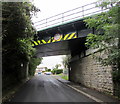
North side of Eagleswell Road railway bridge, Boverton
The bridge, identifier VOG 9 04.5, carries the Vale of Glamorgan Line railway.
Headroom shown is 4.3 metres/14' 0". A Welcome to Boverton sign https://www.geograph.org.uk/photo/6277168 is on the left.
Image: © Jaggery
Taken: 25 Sep 2019
0.09 miles
9
Leigh Close, Boverton
On the west side of Eagleswell Road.
Image: © Jaggery
Taken: 25 Sep 2019
0.09 miles
10
Eagleswell Cottages, Eagleswell Road, Boverton
Row of cottages on the ascent from Boverton to Llantwit Major.
Image: © Jaggery
Taken: 25 Sep 2019
0.09 miles


