1
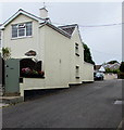
Percy Smith Road, Boverton
From the east side of Eagleswell Road, Percy Smith Road leads to Harding Close, Glanymor and Gaskell Close.
Image: © Jaggery
Taken: 25 Sep 2019
0.02 miles
2
The Boverton Castle, Boverton, Llantwit Major (Re-vamped)
Fully refurbished interior, new external paintwork and improved menu makes the pub well worth visiting once more. http://www.geograph.org.uk/photo/854298
Image: © Mick Lobb
Taken: 26 Feb 2011
0.04 miles
3
Old Post Office, Eagleswell Road, Boverton
Now a private residence, in September 2019 the Old Post Office
is located about 100 metres from the present-day village post office. https://www.geograph.org.uk/photo/6277000
Image: © Jaggery
Taken: 25 Sep 2019
0.05 miles
4
Cottages on Eagleswell Road - Boverton
The majority of the houses to the north-west, and indeed the rest of the village, date from the 1950's onward. Expansion of it and the nearby town of Llantwit Major resulted from the building of Royal Air Force St Athan, located to the north-east, in the late 1930's with several estates being built to accommodate servicemen and civilians who were based there. The '60s and '70s saw a considerable change in service life and it became more common for married personnel to live off the site to the present time when single personnel also choose where they want to live. With the decline of the base, from a strength exceeding 12,000 in the '40s to probably less than a thousand now the area serves as a dormitory location for those who have retired here or who work in Cardiff and other large communities along the M4 corridor in Wales. These cottages pre-date this expansion. See http://www.geograph.org.uk/photo/855232
Image: © Mick Lobb
Taken: 18 Sep 2010
0.05 miles
5
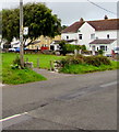
West side of Eagleswell Road, Boverton
Houses alongside the ascent from Boverton towards Llantwit Major.
Image: © Jaggery
Taken: 25 Sep 2019
0.05 miles
6
Blockley's Barber's shop - Boverton
A small salon at the side of the Boverton Castle pub. Handy for those who tell their wives/partners/girlfriends that they are just nipping out for a trim!
Image: © Mick Lobb
Taken: 18 Sep 2010
0.05 miles
7
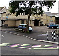
The Boverton Castle, Eagleswell Road, Boverton
Pub at the southern end of Eagleswell Road viewed across Boverton Road.
Image: © Jaggery
Taken: 25 Sep 2019
0.05 miles
8
The Boverton Castle, Boverton, Llantwit Major
Image: © Mick Lobb
Taken: 22 Jun 2008
0.05 miles
9
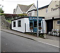
The Cutting Room, Eagleswell Road, Boverton
Unisex hair salon in a single-storey building alongside the Boverton Castle pub viewed in September 2019. Blockley's Barbers https://www.geograph.org.uk/photo/2074310 was here in September 2010.
Image: © Jaggery
Taken: 25 Sep 2019
0.05 miles
10
Eagleswell Road bus stop opposite Percy Smith Road, Boverton
This is a stop on bus route 303 from Barry to Bridgend, in September 2019 operated by NAT Group.
Image: © Jaggery
Taken: 25 Sep 2019
0.05 miles


