IMAGES TAKEN NEAR TO
Brook Lane, CARDIFF, CF5 6TB
Introduction
This page details the photographs taken nearby to Brook Lane, CF5 6TB by members of the Geograph project.
The Geograph project started in 2005 with the aim of publishing, organising and preserving representative images for every square kilometre of Great Britain, Ireland and the Isle of Man.

There are currently over 7.5m images from over14,400 individuals and you can help contribute to the project by visiting https://www.geograph.org.uk
Image Map
Images are licensed for reuse under creativecommons.org/licenses/by-sa/2.0
Notes
- Clicking on the map will re-center to the selected point.
- The higher the marker number, the further away the image location is from the centre of the postcode.
Image Listing (5 Images Found)
Images are licensed for reuse under creativecommons.org/licenses/by-sa/2.0
Image
Details
Distance
2
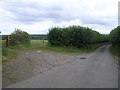
Stile and Footpath, St.Nicholas
The footpath crosses Brook Lane here on its way to Dyffryn about 2kms to the south.
Image: © Guy Butler-Madden
Taken: 17 Feb 2012
0.10 miles
3
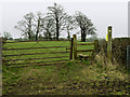
Stile and Gate off Brook Lane
The associated footpath runs for a short distance to Tre-hill near St.Nicholas
Image: © Guy Butler-Madden
Taken: 19 Feb 2014
0.10 miles
4
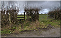
Farm Gate with Footpath Access
Public footpath across farmland at St.Nicholas.
Image: © Alan Hughes
Taken: 24 Jul 2017
0.10 miles
5
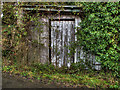
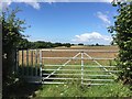
Old Shed, Brook Lane
The shed looks to be disused.
Image: © Guy Butler-Madden
Taken: 19 Feb 2014
0.20 miles