1
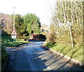
Bent-back bends sign, St George's
The damaged, bent-back old-style sign is on Castle Green in the hamlet of St George's-super-Ely.
Its message BENDS FOR 1½ MILES is still clear to pedestrians, but probably not to its intended readers, passing motorists.
Image: © Jaggery
Taken: 15 Nov 2010
0.01 miles
2
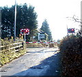
Level crossing ahead, St George's
Just west of Castle Green, signs warn of a level crossing ahead. This is St George's-super-Ely, Vale of Glamorgan.
Image: © Jaggery
Taken: 15 Nov 2010
0.01 miles
3
Castle Green, St George's
The central residential area of the hamlet of St George's-super-Ely, Vale of Glamorgan.
Image: © Jaggery
Taken: 15 Nov 2010
0.01 miles
4
Road surfacing in progress - St George's
Rather more work than merely filling in the potholes following the harsh winter of 2009/10 here.
Image: © Mick Lobb
Taken: 1 Mar 2010
0.02 miles
5
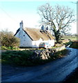
Ty Fynnon cottage - St George's
A whitewashed stone rubble cottage with a thatched roof thought to be of early 19th century origin.
Image: © Mick Lobb
Taken: 1 Mar 2010
0.05 miles
6
Thatched Cottage
Thatched Cottage at St.George's super Ely.
Image: © Alan Hughes
Taken: 19 Feb 2016
0.05 miles
7
Ty-ffynnon cottage, St George's
Grade 2 listed thatched cottage, probably dating from the early 19th century. It is located at the southern edge of the main residential area of the hamlet of St George's-super-Ely.
Image: © Jaggery
Taken: 15 Nov 2010
0.06 miles
8
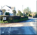
Risk of grounding 100 yards, St George's
At a road junction in the hamlet of St George's-super-Ely, a sign warns of the risk of grounding, illustrated by exaggerated mounds beneath a grounded vehicle. The grounding hazard is not specified, and the angle of the sign makes in unclear which of the two roads contains the hazard. It may be a level crossing, about 180 yards to the north along the road on the right.
Image: © Jaggery
Taken: 15 Nov 2010
0.06 miles
9
Road junction, St George's
The road north http://www.geograph.org.uk/photo/2161706 from the A48 approaches a T junction in St George's-super-Ely. Left for St Bride's-super-Ely (¾ mile) or right for Drope (1 mile) and Cardiff. The 6¼ miles shown is the distance to Cardiff city centre.
Image: © Jaggery
Taken: 15 Nov 2010
0.06 miles
10
Barriers down, St George's level crossing
The level crossing barriers are down and red lights are flashing. The busy South Wales main line passes through the crossing, and on this occasion, two trains, one in each direction, went by within a minute, before the barriers were raised.
Image: © Jaggery
Taken: 15 Nov 2010
0.07 miles


