1
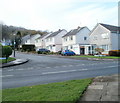
Northern arm of Gwenfo Drive, Wenvoe
Houses on the north side of the road, viewed across Old Port Road.
Gwenfo Drive follows a course similar to an inverted U on the west side of Old Port Road. http://www.geograph.org.uk/photo/2167688 to the southern arm.
Image: © Jaggery
Taken: 19 Nov 2010
0.03 miles
2
Lane at the northern edge of Wenvoe
An unnamed lane runs between a field http://www.geograph.org.uk/photo/2167662 and houses on Greave Close http://www.geograph.org.uk/photo/2167672 at the northern edge of the village of Wenvoe, Vale of Glamorgan.
Image: © Jaggery
Taken: 19 Nov 2010
0.04 miles
3
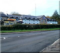
Greave Close, Wenvoe
Houses on the south side of the close, near the northern edge of Wenvoe.
Image: © Jaggery
Taken: 19 Nov 2010
0.04 miles
4
Southern arm of Gwenfo Drive, Wenvoe
Gwenfo Drive follows a course similar to an inverted U on the west side of Old Port Road. This view is along its southern arm, from the corner of Old Port Road. http://www.geograph.org.uk/photo/2167682 to houses along its northern arm.
Image: © Jaggery
Taken: 19 Nov 2010
0.09 miles
5
Walston Castle, Wenvoe
Beefeater restaurant and pub, on the corner of Port Road and Nant Isaf, next door to a Premier Inn. http://www.geograph.org.uk/photo/2167650
Image: © Jaggery
Taken: 19 Nov 2010
0.13 miles
6
Premier Inn, Wenvoe
Hotel located on Port Road, next door to Walston Castle pub and restaurant. http://www.geograph.org.uk/photo/2167645
Named 'Cardiff West' by Premier Inn, the hotel is actually at the NE edge of the village of Wenvoe, Vale of Glamorgan. It is 8 miles from Cardiff city centre and 7 miles from Cardiff International Airport at Rhoose.
Image: © Jaggery
Taken: 19 Nov 2010
0.13 miles
7
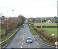
Port Road heading north, Wenvoe
The A4050 viewed from a footbridge. Here known as Port Road, the A4050 is effectively the Wenvoe bypass. It is about 100 metres east of the former trunk road, renamed Old Port Road, the main road through the residential part of the village.
Image: © Jaggery
Taken: 19 Nov 2010
0.14 miles
8
Grange Close, Wenvoe
Houses on the east side of Grange Close, viewed from the corner of Old Port Road.
Image: © Jaggery
Taken: 19 Nov 2010
0.15 miles
9
Motel - Wenvoe
Premier Inn and Beefeater, Wenvoe.
Image: © Alan Hughes
Taken: 4 Apr 2016
0.16 miles
10
Field on the west side of Old Port Road, Wenvoe
In the distance (1300 metres away) is the 261 metre (855 feet) high Wenvoe television transmission mast, actually located in St Lythans Down, outside the village of Wenvoe.
Image: © Jaggery
Taken: 19 Nov 2010
0.16 miles


