
IMAGES TAKEN NEAR TO
Pantglas Fawr, MERTHYR TYDFIL, CF48 4TH
Introduction
This page details the photographs taken nearby to Pantglas Fawr, CF48 4TH by members of the Geograph project.
The Geograph project started in 2005 with the aim of publishing, organising and preserving representative images for every square kilometre of Great Britain, Ireland and the Isle of Man.

There are currently over 7.5m images from over14,400 individuals and you can help contribute to the project by visiting https://www.geograph.org.uk
Image Map
Images are licensed for reuse under creativecommons.org/licenses/by-sa/2.0
Notes
- Clicking on the map will re-center to the selected point.
- The higher the marker number, the further away the image location is from the centre of the postcode.
Image Listing (20 Images Found)
Images are licensed for reuse under creativecommons.org/licenses/by-sa/2.0
Image
Details
Distance
1

Pantglas Fawr, Aberfan
Cul-de-sac at the northern edge of Aberfan, viewed across the road to Troedyrhiw (the B4285).
Image: © Jaggery
Taken: 5 Jul 2012
0.06 miles
2

Northern boundary of Aberfan
The B4285 from Troedyrhiw reaches the village of Aberfan, part of the Merthyr Vale community in Merthyr Tydfil County Borough.
Image: © Jaggery
Taken: 5 Jul 2012
0.08 miles
3

Plantation Cottages, Aberfan
The pair of cottages are alongside the B4285, the road to Troedyrhiw.
Image: © Jaggery
Taken: 5 Jul 2012
0.08 miles
4

Telephone box at junction of The Grove & Aberfan Road
Image: © Nick Mutton 01329 000000
Taken: 23 Sep 2007
0.09 miles
5

Merthyr Vale Renewal Area, Aberfan
The large sign is near the Aberfan boundary sign http://www.geograph.org.uk/photo/3032595 alongside the B4285, the road from Troedyrhiw. A gold-on-black plaque on the wall shows MERTHYR VALE WARD RENEWAL AREA 2001-2011.
Image: © Jaggery
Taken: 5 Jul 2012
0.10 miles
6

Path between Troed-y-rhiw and Aberfan
The path is part of National Cycle Network route 8.
Image: © DS Pugh
Taken: 24 Jun 2024
0.10 miles
7
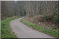
Taff Trail, Aberfan
The Taff Trail is a cycle and walking route that broadly follows the River Taff from Cardiff to Brecon. This stretch follows the course of the long-abandoned Glamorganshire Canal.
Image: © Stephen McKay
Taken: 19 Mar 2013
0.14 miles
8
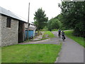
Taff Trail (NCN route 8) near Aberfan. On the left is the entrance to Ynysygored Farm.
Image: © Gareth James
Taken: 2 Aug 2010
0.15 miles
9
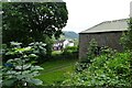
Ynysygored Farm
The farm is located beside part of National Cycle Network route 8.
Image: © DS Pugh
Taken: 24 Jun 2024
0.15 miles
10
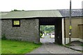
Path through Ynysygored Farm
Looking towards Stryd Cae Derw from National Cycle Network route 8.
Image: © DS Pugh
Taken: 24 Jun 2024
0.16 miles