IMAGES TAKEN NEAR TO
Moy Road, MERTHYR TYDFIL, CF48 4QR
Introduction
This page details the photographs taken nearby to Moy Road, CF48 4QR by members of the Geograph project.
The Geograph project started in 2005 with the aim of publishing, organising and preserving representative images for every square kilometre of Great Britain, Ireland and the Isle of Man.

There are currently over 7.5m images from over14,400 individuals and you can help contribute to the project by visiting https://www.geograph.org.uk
Image Map
Images are licensed for reuse under creativecommons.org/licenses/by-sa/2.0
Notes
- Clicking on the map will re-center to the selected point.
- The higher the marker number, the further away the image location is from the centre of the postcode.
Image Listing (110 Images Found)
Images are licensed for reuse under creativecommons.org/licenses/by-sa/2.0
Image
Details
Distance
1

Small public garden, Aberfan
Located on the east side of Aberfan Road, between Mackintosh Street and Mervyn Street. The plaque in front of the tree states that the garden is the work of young people from abroad and residents of this community, 1976-77.
Image: © Jaggery
Taken: 5 Jul 2012
0.02 miles
2

Aberfan Road houses, Aberfan
Houses on the east side of Aberfan Road viewed from the corner of Barrington Street.
Image: © Jaggery
Taken: 5 Jul 2012
0.02 miles
3
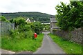
Path to Aberfan Road
Connecting Moy Road to Aberfan Road in Aberfan.
Image: © DS Pugh
Taken: 24 Jun 2024
0.02 miles
4

Moy Road
Houses on Moy Road just south of the memorial garden to the Aberfan disaster.
Image: © DS Pugh
Taken: 24 Jun 2024
0.03 miles
5

Garden beside Aberfan Road
A small garden in Aberfan connecting Aberfan Road and Cottrell Street.
Image: © DS Pugh
Taken: 24 Jun 2024
0.04 miles
6

Aberfan Road
Looking towards the junction with Mackintosh Street.
Image: © DS Pugh
Taken: 24 Jun 2024
0.04 miles
7

Aberfan Cemetery
This photograph was taken in 1984 on a visit to support the South Wales Miners at the Deep Navigation Colliery at Treharris. Part of the day involved visiting the Aberfan Cemetery to pay respects to the victims of the 1966 disaster when on October 21st 1966 part of the village and a whole school was indundated with mud from a slurry tip, killing 144 people, including half the children at the school.
The impact of such an event on a small community is hard to imagine. The long rows of white memorial arches on the graves of the victims (in the top left of this picture) are a moving testimony.
I cannot vouch for the exact accuracy of the location. I have made a best guess from Google maps.
Image: © Tom Jolliffe
Taken: Unknown
0.04 miles

9
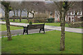
Aberfan Memorial Garden
The memorial garden has been established on the site of the Pantglas Junior School which was destroyed by a colliery tip in 1966.
Image: © Stephen McKay
Taken: 19 Mar 2013
0.06 miles
10

Garden of Remembrance
The garden of remembrance, Aberfan. 116 children and 28 adults lost their lives in the disaster of 21st October 1966.
Image: © Alan Hughes
Taken: 31 Mar 2016
0.06 miles