
IMAGES TAKEN NEAR TO
Griffith Terrace, MERTHYR TYDFIL, CF48 4PW
Introduction
This page details the photographs taken nearby to Griffith Terrace, CF48 4PW by members of the Geograph project.
The Geograph project started in 2005 with the aim of publishing, organising and preserving representative images for every square kilometre of Great Britain, Ireland and the Isle of Man.

There are currently over 7.5m images from over14,400 individuals and you can help contribute to the project by visiting https://www.geograph.org.uk
Image Map
Images are licensed for reuse under creativecommons.org/licenses/by-sa/2.0
Notes
- Clicking on the map will re-center to the selected point.
- The higher the marker number, the further away the image location is from the centre of the postcode.
Image Listing (93 Images Found)
Images are licensed for reuse under creativecommons.org/licenses/by-sa/2.0
Image
Details
Distance
1
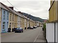
Looking south along Bryn Taf, Aberfan, from its northern end
Since the closure of Merthyr Vale Colliery in the 1980's the appearance of parts of Aberfan has changed substantially - but not so much here, at the north end of Bryn Taf.
Because Bryn Taf follows the contour along the valley side, this view gives little impression of the steepness of the terrain. Just out of the frame to the right the hillside rises steeply. The ridge visible in the distance is on the far side of this narrow valley, going south towards Quakers Yard.
Behind the camera the road zigzags down Station Hill toward the village centre.
The life of the valley since Victorian times is documented in a collection of old photographs to be found on Alan George's excellent website http://www.alangeorge.co.uk/old_merthyr.htm.
Image: © Stefan Czapski
Taken: 20 Jun 2011
0.01 miles
2
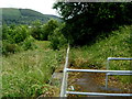
Site of Aberfan railway station
Viewed from the south side of a hairpin bend. http://www.geograph.org.uk/photo/3343014 Grass now grows where once stood Aberfan railway station, which closed in 1951. The nearest station is now in Merthyr Vale. http://www.geograph.org.uk/photo/3024730
Image: © Jaggery
Taken: 5 Jul 2012
0.03 miles
3
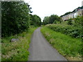
Footpath and cycleway near the site of Aberfan railway station
My first thought on seeing this path was that perhaps this was the route of the former railway line through Aberfan, near the long since demolished station. However, a 1940s map shows the railway
a little to the left, on the far side of the trees. Aberfan railway station closed in 1951.
Image: © Jaggery
Taken: 5 Jul 2012
0.03 miles
4
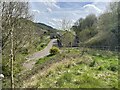
Aberfan railway station (site), Mid Glamorgan
Opened in 1886 jointly by the Great Western Railway and the Rhymney Railway on the line from Quakers Yard (High Level) to Merthyr, this station closed to passengers in 1951 and completely in 1954.
View south from the former bridge (now filled in and embanked) over the tracks towards Pontygwaith and Quakers Yard. The road next to the houses is on the course of the railway which had parallel platforms on either side. The station building was on the immediate far left of the image. The railings on the right mark the course of the footpath down to the northbound platform. The site was redeveloped for housing around 2016.
For more information, see http://www.disused-stations.org.uk/a/aberfan/index.shtml.
Image: © Nigel Thompson
Taken: 12 Apr 2024
0.03 miles
5
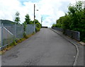
Station Hill, Aberfan
Station Hill climbs away from the junction with Aberfan Road and Aberfan Crescent towards a hairpin bend. This was formerly the approach road to Aberfan railway station, which closed in 1951.
Image: © Jaggery
Taken: 5 Jul 2012
0.04 miles
6
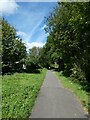
Taff Trail on southern outskirts of Aberfan
Image: © David Smith
Taken: 17 Sep 2022
0.04 miles
7
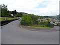
Left side of a hairpin bend, Aberfan
The course of Station Hill here bends through 180 degrees. The road on the left climbs towards Aberfan Cemetery. http://www.geograph.org.uk/photo/3343015 to the right side of the bend.
Image: © Jaggery
Taken: 5 Jul 2012
0.05 miles
8
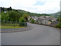
Right side of a hairpin bend, Aberfan
This side of Station Hill descends towards the junction of Aberfan Road and Aberfan Crescent.
http://www.geograph.org.uk/photo/3343014 to the left side of the bend.
Image: © Jaggery
Taken: 5 Jul 2012
0.05 miles
9
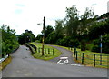
Road, footpath and cycleway, Aberfan
The road on the left descends towards a hairpin bend. www.geograph.org.uk/photo/3343014
The footpath on the right is also a cycleway, for bicycles only. Motorbikes are banned
from using the path by a circular red-edged sign on the path's surface.
Image: © Jaggery
Taken: 5 Jul 2012
0.06 miles
10

Horses at Aberfan
Two horses occupy a steep and muddy paddock on the slopes above Aberfan.
Image: © Stephen McKay
Taken: 19 Mar 2013
0.07 miles