IMAGES TAKEN NEAR TO
Upper Mount Pleasant, MERTHYR TYDFIL, CF48 4NB

Introduction

This page details the photographs taken nearby to Upper Mount Pleasant, CF48 4NB by members of the Geograph project.

The Geograph project started in 2005 with the aim of publishing, organising and preserving representative images for every square kilometre of Great Britain, Ireland and the Isle of Man.

There are currently over 7.5m images from over14,400 individuals and you can help contribute to the project by visiting https://www.geograph.org.uk

Image Map


Images are licensed for reuse under creativecommons.org/licenses/by-sa/2.0
Notes
  • Clicking on the map will re-center to the selected point.
  • The higher the marker number, the further away the image location is from the centre of the postcode.

Image Listing (122 Images Found)

Images are licensed for reuse under creativecommons.org/licenses/by-sa/2.0
  • ...
Image
Details
Distance
1
Ordnance Survey Cut Mark
This OS cut mark can be found on No43 Cardiff Road. It marks a point 147.791m above mean sea level.
Image: © Adrian Dust Taken: 14 Apr 2018
0.07 miles
2
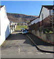
Zion Close, Troedyrhiw
On the east side of the A4054 Cardiff Road viewed in February 2019. Mount Zion English Congregational Chapel was formerly nearby. The chapel was demolished in 2004.
Image: © Jaggery Taken: 25 Feb 2019
0.07 miles
3
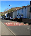
20 on Cardiff Road, Troedyrhiw
20 mph speed limit on the A4054 Cardiff Road near Wyndham Street.
Image: © Jaggery Taken: 25 Feb 2019
0.07 miles
4
Chapel Street houses, Troedyrhiw
These houses on the east side of Chapel Street are set several metres above the roadway.
Image: © Jaggery Taken: 13 Jun 2012
0.08 miles
5
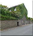
Ivy-clad house, Troedyrhiw
Located at the southern end of Chapel Street, adjacent to Thomas Jones Square.
Image: © Jaggery Taken: 13 Jun 2012
0.08 miles
6
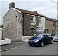
Would suit keen DIY enthusiast, Troedyrhiw
There is a For Sale sign over a boarded-up window on the front of this end-of-terrace Chapel Street house, but the numbers following the £ sign have been cut away. The front of the house is partly bare stone and partly white-painted.
Image: © Jaggery Taken: 13 Jun 2012
0.08 miles
7
Industrial Terrace, Troedyrhiw
Viewed across the A4054 Cardiff Road.
Image: © Jaggery Taken: 25 Feb 2019
0.08 miles
8
Wyndham Street, Troedyrhiw
Viewed from the edge of the A4054 Cardiff Road looking towards Bridge Street.
Image: © Jaggery Taken: 25 Feb 2019
0.09 miles
9
Railway line in Troedyrhiw
Image: © Gareth James Taken: 21 Oct 2016
0.10 miles
10
From 20 to 30 on Cardiff Road, Troedyrhiw
The 20mph speed limit on the A4054 Cardiff Road increases to 30mph.
Image: © Jaggery Taken: 25 Feb 2019
0.10 miles
  • ...