
IMAGES TAKEN NEAR TO
Rhodfa Terrace, MERTHYR TYDFIL, CF48 4JG
Introduction
This page details the photographs taken nearby to Rhodfa Terrace, CF48 4JG by members of the Geograph project.
The Geograph project started in 2005 with the aim of publishing, organising and preserving representative images for every square kilometre of Great Britain, Ireland and the Isle of Man.

There are currently over 7.5m images from over14,400 individuals and you can help contribute to the project by visiting https://www.geograph.org.uk
Image Map
Images are licensed for reuse under creativecommons.org/licenses/by-sa/2.0
Notes
- Clicking on the map will re-center to the selected point.
- The higher the marker number, the further away the image location is from the centre of the postcode.
Image Listing (160 Images Found)
Images are licensed for reuse under creativecommons.org/licenses/by-sa/2.0
Image
Details
Distance
1
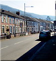
Start of the 20 zone on Merthyr Road, Troedyrhiw
The 30mph speed limit on the A4054 Merthyr Road drops to 20mph on the approach to Troedyrhiw Community Primary School. PARTH on the signs is Welsh for ZONE.
Image: © Jaggery
Taken: 27 Feb 2019
0.01 miles
2

Rhodfa Terrace, Troedyrhiw
Long row of houses alongside the A4054 viewed from the corner of Pembroke Street.
Image: © Jaggery
Taken: 27 Feb 2019
0.02 miles
3

Houses on the north side of Archer Street, Troedyrhiw
Viewed looking towards the A4054 Merthyr Road.
Image: © Jaggery
Taken: 8 Mar 2019
0.03 miles
4
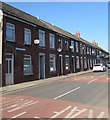
Ladysmith Place satellite dishes, Troedyrhiw
In February 2019 satellite dishes at varying heights above
pavement level are on Ladysmith Place houses alongside the A4054.
Image: © Jaggery
Taken: 27 Feb 2019
0.03 miles
5
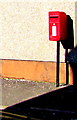
Queen Elizabeth II postbox, Pembroke Street, Troedyrhiw
On the left here. https://www.geograph.org.uk/photo/6073798
Image: © Jaggery
Taken: 27 Feb 2019
0.03 miles
6
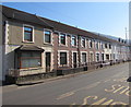
Tydfil Terrace, Troedyrhiw
Long row of houses alongside the A4054 Merthyr Road.
Image: © Jaggery
Taken: 27 Feb 2019
0.04 miles
7
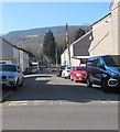
Archer Street in Troedyrhiw
Dead-end street on the west side of the A4054 Merthyr Road.
Image: © Jaggery
Taken: 27 Feb 2019
0.04 miles
8

Line spur pole on a bank in Troedyrhiw
This part of the Western Power Distribution electricity supply
infrastructure is about 60 metres east of the A4054 Merthyr Road.
Image: © Jaggery
Taken: 27 Feb 2019
0.04 miles
9

Taldwyn Terrace, Troedyrhiw
Long row of houses alongside the A4054 viewed from the corner of Archer Street.
Image: © Jaggery
Taken: 27 Feb 2019
0.05 miles
10
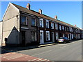
Greenfield Terrace, Troedyrhiw
Viewed across the A4054 Merthyr Road. Greenfield Terrace is between Pembroke Street and South View.
Image: © Jaggery
Taken: 27 Feb 2019
0.06 miles