
IMAGES TAKEN NEAR TO
Holly Terrace, MERTHYR TYDFIL, CF48 4HS
Introduction
This page details the photographs taken nearby to Holly Terrace, CF48 4HS by members of the Geograph project.
The Geograph project started in 2005 with the aim of publishing, organising and preserving representative images for every square kilometre of Great Britain, Ireland and the Isle of Man.

There are currently over 7.5m images from over14,400 individuals and you can help contribute to the project by visiting https://www.geograph.org.uk
Image Map
Images are licensed for reuse under creativecommons.org/licenses/by-sa/2.0
Notes
- Clicking on the map will re-center to the selected point.
- The higher the marker number, the further away the image location is from the centre of the postcode.
Image Listing (47 Images Found)
Images are licensed for reuse under creativecommons.org/licenses/by-sa/2.0
Image
Details
Distance
1

Holly Terrace in Troedyrhiw
Row of houses extending for 50 metres alongside the A4054.
Image: © Jaggery
Taken: 27 Feb 2019
0.01 miles
2

Hazel Terrace, Troedyrhiw
Long row of houses alongside the A4054.
Image: © Jaggery
Taken: 27 Feb 2019
0.02 miles
3

Yellow speed camera in Troedyrhiw
Alongside the A4054 opposite Hazel Terrace.
Image: © Jaggery
Taken: 27 Feb 2019
0.03 miles
4
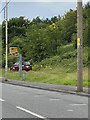
Speed camera
Traffic enforcement camera on A4054 near Troedyrhiw.
Image: © Alan Hughes
Taken: 31 Jul 2020
0.03 miles
5
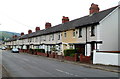
Holly Terrace, Troedyrhiw
Viewed across the A4054 Merthyr Road. There are four rows of houses here, separately named, but sharing the same numbering sequence. Nearest the camera, the 10 houses are 25-34 Holly Terrace. Beyond the nearest car, the next row is 15-24 Hazel Terrace. At first floor level between each house is a distinctive black lozenge, perhaps originally used to secure electricity cabling.
Image: © Jaggery
Taken: 13 Jun 2012
0.05 miles
6
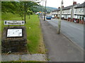
Troedyrhiw information board
An information board is on a stone plinth alongside Merthyr Road (A4054) near the NW boundary of Troedyrhiw. The information includes a history of the village, modern-day Troedyrhiw and some people associated with the area.
Image: © Jaggery
Taken: 13 Jun 2012
0.05 miles
7
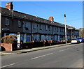
Laburnam Terrace, Troedyrhiw
Row of houses extending for 50 metres along the west side of the A4054 Merthyr Road.
The name sign on the wall on the left shows LABURNAM TERRACE.
I wondered if laburnam is the Welsh form of laburnum. It isn't - it's tresi aur.
Image: © Jaggery
Taken: 27 Feb 2019
0.07 miles
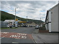
9
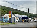
Car wash
Not much business today at the Troedyrhiw car wash.
Image: © Alan Hughes
Taken: 31 Jul 2020
0.08 miles
10

Entrance to Linde Industrial Park, Pentrebach
There is retaining meshing on the wall on the north side of the private road from Merthyr Road into Linde Industrial Park.
Image: © Jaggery
Taken: 13 Jun 2012
0.08 miles