
IMAGES TAKEN NEAR TO
Elm Street, MERTHYR TYDFIL, CF48 4EA
Introduction
This page details the photographs taken nearby to Elm Street, CF48 4EA by members of the Geograph project.
The Geograph project started in 2005 with the aim of publishing, organising and preserving representative images for every square kilometre of Great Britain, Ireland and the Isle of Man.

There are currently over 7.5m images from over14,400 individuals and you can help contribute to the project by visiting https://www.geograph.org.uk
Image Map
Images are licensed for reuse under creativecommons.org/licenses/by-sa/2.0
Notes
- Clicking on the map will re-center to the selected point.
- The higher the marker number, the further away the image location is from the centre of the postcode.
Image Listing (182 Images Found)
Images are licensed for reuse under creativecommons.org/licenses/by-sa/2.0
Image
Details
Distance
1
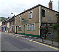
Angel Inn, Troedyrhiw
Bridge Street pub adjacent to the west side of the railway bridge.
Image: © Jaggery
Taken: 13 Jun 2012
0.01 miles
2
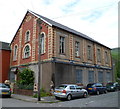
Former Tabernacle Baptist chapel, Troedyrhiw
Built in 1895, on the corner of Yew Street and Elm Street.
Image: © Jaggery
Taken: 13 Jun 2012
0.01 miles
3
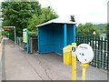
Help point and a tiny shelter, Troedyrhiw railway station
The station http://www.geograph.org.uk/photo/2995478 is unstaffed. Passengers can use the help point to find out information about train times, delays etc. The blue shelter is located at the top of the ramp up from Bridge Street.
Image: © Jaggery
Taken: 13 Jun 2012
0.01 miles
4
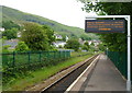
Departure information, Troedyrhiw railway station
The display shows that the next departures from the station http://www.geograph.org.uk/photo/2995478, to Barry Island and to Merthyr Tydfil are on time. The line behind the camera is single track all the way to the terminus at Merthyr Tydfil. The track is doubled to the SE of the station, to let trains pass each other.
Image: © Jaggery
Taken: 13 Jun 2012
0.01 miles
5
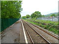
Long platform at Troedyrhiw railway station
At about 170 metres, the single platform at the station http://www.geograph.org.uk/photo/2995478 is far longer
than the trains stopping here in 2012, which have at most four coaches.
Image: © Jaggery
Taken: 13 Jun 2012
0.01 miles
6
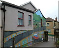
Mural at the entrance to Troedyrhiw railway station
The mural is on the wall of a Bridge Street house.
Image: © Jaggery
Taken: 13 Jun 2012
0.01 miles
7
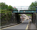
Railway bridge, Bridge Street, Troedyrhiw
Troedyrhiw railway station http://www.geograph.org.uk/photo/2995478 is immediately to the right of the bridge. On the other side of the bridge are The Railway pub and the village post office. http://www.geograph.org.uk/photo/2995034
Image: © Jaggery
Taken: 13 Jun 2012
0.01 miles
8
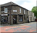
Rona's Shoe Shop, Troedyrhiw
On the corner of Bridge Street and Wyndham Street. In addition to shoes, the shop sells items such as handbags and umbrellas.
Image: © Jaggery
Taken: 13 Jun 2012
0.01 miles
9
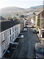
Elm Street in Troedyrhiw
Viewed from Troedyrhiw railway station looking towards the Yew Street intersection.
Image: © Jaggery
Taken: 25 Feb 2019
0.02 miles
10
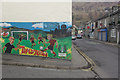
Bridge Street, Troedyrhiw
The mural By Troedyrhiw Boys and Girls Club depicts a football match with, in the background, a hint of South Wales' once great coal industry of which little trace now remains.
Image: © Stephen McKay
Taken: 19 Mar 2013
0.03 miles