
IMAGES TAKEN NEAR TO
Plymouth Gardens, MERTHYR TYDFIL, CF48 4BA
Introduction
This page details the photographs taken nearby to Plymouth Gardens, CF48 4BA by members of the Geograph project.
The Geograph project started in 2005 with the aim of publishing, organising and preserving representative images for every square kilometre of Great Britain, Ireland and the Isle of Man.

There are currently over 7.5m images from over14,400 individuals and you can help contribute to the project by visiting https://www.geograph.org.uk
Image Map
Images are licensed for reuse under creativecommons.org/licenses/by-sa/2.0
Notes
- Clicking on the map will re-center to the selected point.
- The higher the marker number, the further away the image location is from the centre of the postcode.
Image Listing (90 Images Found)
Images are licensed for reuse under creativecommons.org/licenses/by-sa/2.0
Image
Details
Distance
1
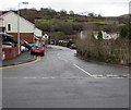
Plymouth Gardens, Pentrebach
Cul-de-sac viewed across Greenfield Terrace.
Image: © Jaggery
Taken: 4 Mar 2019
0.02 miles
2
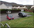
Parking area in Pentrebach
Set back from the corner of Castle Street and Chapel Close.
Image: © Jaggery
Taken: 4 Mar 2019
0.02 miles
3
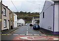
Castle Street, Pentrebach
From Greenfield Terrace, Castle Street leads to Hamilton Street,
Jerusalem Baptist Church https://www.geograph.org.uk/photo/6078987 and Chapel Close.
Image: © Jaggery
Taken: 4 Mar 2019
0.03 miles
4
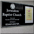
Jerusalem Baptist Church nameboard, Pentrebach
On the wall here https://www.geograph.org.uk/photo/6078987 viewed in March 2019.
Image: © Jaggery
Taken: 4 Mar 2019
0.03 miles
5
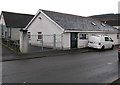
Jerusalem Baptist Church, Castle Street, Pentrebach
In a single-storey building.
Image: © Jaggery
Taken: 4 Mar 2019
0.03 miles
6
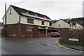
Rooftop solar panels, Plymouth Gardens, Pentrebach
At the SW end of Plymouth Gardens viewed across Greenfield Terrace.
Image: © Jaggery
Taken: 4 Mar 2019
0.04 miles
7
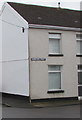
Old-style name sign, Hamilton Street, Pentrebach
An enamel street name sign is on the wall at the corner of Castle Street.
Image: © Jaggery
Taken: 4 Mar 2019
0.04 miles
8
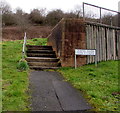
Steps up to a path to Chapel Close houses, Pentrebach
The steps lead to this https://www.geograph.org.uk/photo/6079063 path. The name sign shows that Chapel Close is Clôs y Capel in Welsh.
Image: © Jaggery
Taken: 4 Mar 2019
0.04 miles
9
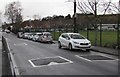
Greenfield Terrace speed bumps, Pentrebach
On the approach to a zebra crossing. https://www.geograph.org.uk/photo/6079115
Image: © Jaggery
Taken: 4 Mar 2019
0.05 miles
10
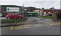
Ysgol Greenfield/Greenfield School entrance, Pentrebach
From Greenfield Terrace. Greenfield School is Ysgol Greenfield in Welsh.
Image: © Jaggery
Taken: 4 Mar 2019
0.05 miles