
IMAGES TAKEN NEAR TO
High Street, MERTHYR TYDFIL, CF48 3HA
Introduction
This page details the photographs taken nearby to High Street, CF48 3HA by members of the Geograph project.
The Geograph project started in 2005 with the aim of publishing, organising and preserving representative images for every square kilometre of Great Britain, Ireland and the Isle of Man.

There are currently over 7.5m images from over14,400 individuals and you can help contribute to the project by visiting https://www.geograph.org.uk
Image Map
Images are licensed for reuse under creativecommons.org/licenses/by-sa/2.0
Notes
- Clicking on the map will re-center to the selected point.
- The higher the marker number, the further away the image location is from the centre of the postcode.
Image Listing (50 Images Found)
Images are licensed for reuse under creativecommons.org/licenses/by-sa/2.0
Image
Details
Distance
1
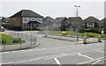
Azalea Park, Caerharris, Dowlais
Modern houses (built c1998) adjacent to High Street, Caeharris.
Image: © Jaggery
Taken: 21 Apr 2010
0.01 miles
2
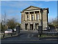
Guest Club, Dowlais
A social club and sports hall that was built in 1863 as a memorial library to John Josiah Guest who was a partner in the Dowlais Iron Company.
The building was designed, based on the Greek Parthenon, by Sir Charles Berry who also designed part of the Houses of Parliament.
The existing British multinational automotive and aerospace components company GKN can trace its origin back to the Dowlais Ironworks, the G referring to John Guest.
A Grade II* Listed Building.
Image: © Robin Drayton
Taken: 7 Nov 2013
0.03 miles
5
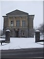
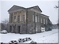
Guest Club, Caeharris
Originally the Guest Memorial Library, a memorial to J.J.Guest the industrialist, designed by Charles Berry. it is now a Free House, available for wedding receptions etc, having previously been a social club and a sports club.
Image: © John Lord
Taken: 4 Feb 2012
0.04 miles
6
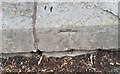
Ordnance Survey Cut Mark
This OS cut mark can be found on the wall at the junction of High Street & Gwernllyn Road. It marks a point 320.036m above mean sea level.
Image: © Adrian Dust
Taken: 13 Jun 2020
0.04 miles
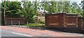
8
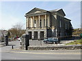
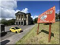
The Guest Memorial Sports & Social Club, Dowlais
Located on High Street. Built in 1863 as Dowlais Iron Company Guest Memorial Library. Its designer, Sir Charles Barry (designer of part of the Houses of Parliament) based his plans on a model of the Parthenon in Athens.
The Guest family were owners of the Iron Company.
Image: © Jaggery
Taken: 21 Apr 2010
0.05 miles
9
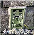
Ordnance Survey Flush Bracket (S1226)
This OS Flush Bracket can be found on the wall NE face of the Works Building on High Street. It marks a point 302.559m above mean sea level.
Image: © Adrian Dust
Taken: 29 Oct 2017
0.07 miles
10
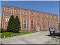
Former blast furnace blowing engine house - Dowlais
This magnificently preserved industrial building is now a community project building and used for indoor sports. The building was built for Guest, Keen & Nettlefolds in 1905-7 to house the blowing engines for new blast furnaces completed in 1909. It is 54 m long and 15 m high and had a single internal space for three very large blowing engines. These were inverted vertical cross compound 'quarter crank' blowing engines with Corliss valves on the steam cylinders. Iron and steel making stopped in 1930 and most of the works closed in 1936. Fortunately this magnificent building survived and is Listed II*.
Image: © Chris Allen
Taken: 5 May 2018
0.07 miles