
IMAGES TAKEN NEAR TO
Odessa Street, MERTHYR TYDFIL, CF48 3AU
Introduction
This page details the photographs taken nearby to Odessa Street, CF48 3AU by members of the Geograph project.
The Geograph project started in 2005 with the aim of publishing, organising and preserving representative images for every square kilometre of Great Britain, Ireland and the Isle of Man.

There are currently over 7.5m images from over14,400 individuals and you can help contribute to the project by visiting https://www.geograph.org.uk
Image Map
Images are licensed for reuse under creativecommons.org/licenses/by-sa/2.0
Notes
- Clicking on the map will re-center to the selected point.
- The higher the marker number, the further away the image location is from the centre of the postcode.
Image Listing (29 Images Found)
Images are licensed for reuse under creativecommons.org/licenses/by-sa/2.0
Image
Details
Distance
1
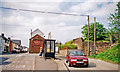
The Bruce, Dowlais (Year 2000)
Photographer Ben Brooksbank's Profile: http://www.geograph.org.uk/profile/44502
The Bruce Hotel on Victoria street in Dowlais, at its intersection with Odessa Street (left) and Station Street. Note the remains of a railway bridge over Station Street. Ivor Iron Works was just a few hundred metres to the North East of this location, until it closed in 1987 (demolished 1988). Dowlais Central Railway Station was just a short distance South of this location. See also Ivor Road, SSE of this location:
http://www.geograph.org.uk/photo/2220754
Image: © Ben Brooksbank (Geograph member)
Taken: Unknown
0.02 miles
2
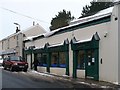
Dowlais Pharmacy
Situated in Victoria Street.
Image: © Robin Drayton
Taken: 11 Jan 2010
0.05 miles
3
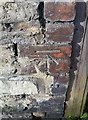
Ordnance Survey Cut Mark
This OS cut mark can be found on the wall west side of Victoria Street. It marks a point 314.078m above mean sea level.
Image: © Adrian Dust
Taken: 29 Oct 2017
0.06 miles
5
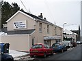
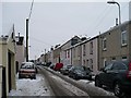
Veterinary Practice, Dowlais
Situated in Victoria Street.
Image: © Robin Drayton
Taken: 11 Jan 2010
0.06 miles
6
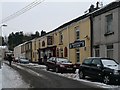
Morlais Tavern, Dowlais
Situated in Mount Pleasant Street http://www.geograph.org.uk/photo/1661883 .
Starting over 100 years ago in one iron workers terraced house, it now occupies the space of four.
Image: © Robin Drayton
Taken: 11 Jan 2010
0.07 miles
9
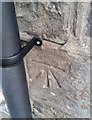
Ordnance Survey Cut Mark
This OS cut mark can be found on the chapel east side of Victoria Street. It marks a point 312.731m above mean sea level.
Image: © Adrian Dust
Taken: 29 Oct 2017
0.08 miles
10
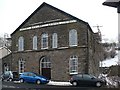
Beulah Baptist Chapel, Dowlais
Situated in Victoria Street.
The date is 1856.
Image: © Robin Drayton
Taken: 11 Jan 2010
0.09 miles