
IMAGES TAKEN NEAR TO
Heol-y-Cae, MERTHYR TYDFIL, CF48 2RT
Introduction
This page details the photographs taken nearby to Heol-y-Cae, CF48 2RT by members of the Geograph project.
The Geograph project started in 2005 with the aim of publishing, organising and preserving representative images for every square kilometre of Great Britain, Ireland and the Isle of Man.

There are currently over 7.5m images from over14,400 individuals and you can help contribute to the project by visiting https://www.geograph.org.uk
Image Map
Images are licensed for reuse under creativecommons.org/licenses/by-sa/2.0
Notes
- Clicking on the map will re-center to the selected point.
- The higher the marker number, the further away the image location is from the centre of the postcode.
Image Listing (41 Images Found)
Images are licensed for reuse under creativecommons.org/licenses/by-sa/2.0
Image
Details
Distance
1
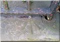
Ordnance Survey Rivet
This OS rivet can be found on the entrance step of No35 High Street. It marks a point 204.829m above mean sea level.
Image: © Adrian Dust
Taken: 5 Nov 2017
0.04 miles
2
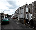
Holford Street towards Pontycapel Road, Cefn-coed-y-cymmer
Looking ESE from the corner of Old Church Street.
Image: © Jaggery
Taken: 16 Jun 2014
0.08 miles
3
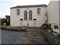
Carmel Chapel, Cefn-coed-y-cymmer
Now a dwelling?
Image: © John Lord
Taken: 11 Aug 2017
0.10 miles
4
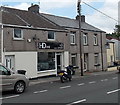
HD ink in Cefn-coed-y-cymmer
Tattoo and body piercing parlour at 164 High Street.
Image: © Jaggery
Taken: 16 Jun 2014
0.10 miles
6
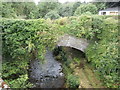
The old bridge over the Taf Fechan at Pont y Cefn
Image: © John Lord
Taken: 11 Aug 2017
0.11 miles
8
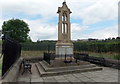
War Memorial, Cefn-coed-y-cymmer
Set back from the north side of High Street, the War Memorial was unveiled in 1924.
Image: © Jaggery
Taken: 16 Jun 2014
0.12 miles
9
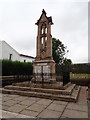
War Memorial, Cefn Coed y Cymmer
Commemorating men from Vaynor parish who perished in WWI
Image: © Eirian Evans
Taken: 22 Jul 2019
0.12 miles
10
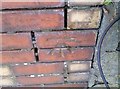
Ordnance Survey Cut Mark
This OS cut mark can be found on the wall of No51 High Street. It marks a point 212.865m above mean sea level.
Image: © Adrian Dust
Taken: 5 Nov 2017
0.12 miles