
IMAGES TAKEN NEAR TO
Pantycelynen, MERTHYR TYDFIL, CF48 1TN
Introduction
This page details the photographs taken nearby to Pantycelynen, CF48 1TN by members of the Geograph project.
The Geograph project started in 2005 with the aim of publishing, organising and preserving representative images for every square kilometre of Great Britain, Ireland and the Isle of Man.

There are currently over 7.5m images from over14,400 individuals and you can help contribute to the project by visiting https://www.geograph.org.uk
Image Map
Images are licensed for reuse under creativecommons.org/licenses/by-sa/2.0
Notes
- Clicking on the map will re-center to the selected point.
- The higher the marker number, the further away the image location is from the centre of the postcode.
Image Listing (42 Images Found)
Images are licensed for reuse under creativecommons.org/licenses/by-sa/2.0
Image
Details
Distance
1
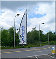
Sail-like name sign at the entrance to Cyfarthfa Retail Park, Merthyr Tydfil
Opened in 2005, Cyfarthfa Retail Park occupies previously derelict industrial land, about a kilometre from Merthyr Tydfil town centre.
Image: © Jaggery
Taken: 13 Jun 2012
0.04 miles
2
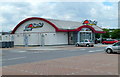
Pizza Hut, Cyfarthfa Retail Park, Merthyr Tydfil
Located on the south side of the retail park, near the entrance.
Pizza Hut is an American restaurant chain and international franchise. There are more than 6,000 Pizza Hut restaurants in the USA, and another c5,600 in the rest of the world.
Image: © Jaggery
Taken: 13 Jun 2012
0.04 miles
3
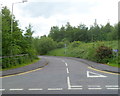
Road to Upper Colliers Row, Merthyr Tydfil
Viewed from the edge of this bridge http://www.geograph.org.uk/photo/3002580 at the eastern edge of the Heolgerrig district of Merthyr Tydfil. The road leads to a row of 17 houses about 300 metres ahead.
Image: © Jaggery
Taken: 13 Jun 2012
0.04 miles
4
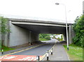
A470 crosses above the road to Heolgerrig, Merthyr Tydfil
Houses at the eastern edge of Heolgerrig can be seen through the bridge.
Image: © Jaggery
Taken: 13 Jun 2012
0.04 miles
5
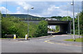
Eastern boundary of Heolgerrig, Merthyr Tydfil
A boundary sign on the left shows HEOLGERRIG, which is part of Cyfarthfa, a community in the county borough of Merthyr Tydfil. The bridge carries the A470.
Image: © Jaggery
Taken: 13 Jun 2012
0.04 miles
6
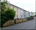
Pantycelynen houses, Heolgerrig, Merthyr Tydfil
Houses in a street named Pantycelynen, between the A470 bridge http://www.geograph.org.uk/photo/3002580 behind the camera, and the turning ahead for Farm Terrace.
Image: © Jaggery
Taken: 13 Jun 2012
0.05 miles
7
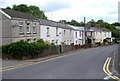
North side of Pantycelynen, Heolgerrig, Merthyr Tydfil
Viewed from the corner of Farm Terrace. http://www.geograph.org.uk/photo/3002726 The houses are in a road named Pantycelynen.
The bridge http://www.geograph.org.uk/photo/3002580 carrying the A470 is out of shot a few metres beyond the far house.
Image: © Jaggery
Taken: 13 Jun 2012
0.05 miles
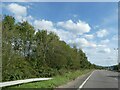
9
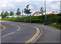
Southern access road to Cyfarthfa Retail Park, Merthyr Tydfil
The top of a Pizza Hut http://www.geograph.org.uk/photo/3002216 can be seen above a hedge.
Image: © Jaggery
Taken: 13 Jun 2012
0.10 miles
10

Currys, Cyfarthfa Retail Park, Merthyr Tydfil
Currys are electrical retailers whose stock includes washing machines, dishwashers, refrigeration, plasma and LCD TVs, laptops, PCs, games consoles and iPods.
Image: © Jaggery
Taken: 13 Jun 2012
0.10 miles