1
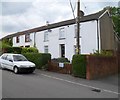
Shirley Drive, Heolgerrig, Merthyr Tydfil
Shirley Drive climbs away from Heolgerrig into the Shirley Gardens area.
Image: © Jaggery
Taken: 13 Jun 2012
0.01 miles
2
Bench and tree, Shirley Drive, Heolgerrig, Merthyr Tydfil
This corner of Heolgerrig was the perfect location for a lunch break!
The speed limit on Heolgerrig reduces to 20mph on the approach to Heolgerrig School
Image: © Jaggery
Taken: 13 Jun 2012
0.05 miles
3
20mph speed limit on Heolgerrig, Merthyr Tydfil
Viewed from the Shirley Drive http://www.geograph.org.uk/photo/3003214 junction. A 20mph applies on the approach to Heolgerrig School.
Image: © Jaggery
Taken: 13 Jun 2012
0.05 miles
4
The Red Lion, Heolgerrig, Merthyr Tydfil
Pub at 82 Heolgerrig.
Image: © Jaggery
Taken: 13 Jun 2012
0.05 miles
5
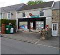
Heolgerrig Post Office, Merthyr Tydfil
Shop and post office at 74-75 Heolgerrig. The name Thomas's, formerly prominent, is now faded.
Image: © Jaggery
Taken: 13 Jun 2012
0.08 miles
6
Ordnance Survey Pivot
This OS pivot can be found on the window sill of No73 Heol Cerrig. It marks a point 259.164m above mean sea level.
Image: © Adrian Dust
Taken: 8 Jul 2021
0.10 miles
7
Belle Vue, Heolgerrig, Merthyr Tydfil
Though overpainted, the name Belle Vue is still legible between upstairs windows
of the house next door to the out-of-shot Red Lion pub. http://www.geograph.org.uk/photo/3003224
Image: © Jaggery
Taken: 13 Jun 2012
0.11 miles
8
Multi-sport games court, Heolgerrig Primary School
Overlapping yellow, blue and white lines mark out playing areas for three sports.
Viewed from the main road through Heolgerrig, also named Heolgerrig.
Image: © Jaggery
Taken: 13 Jun 2012
0.11 miles
9
Six Bells Inn, Heolgerrig, Merthyr Tydfil
Faded text on the nameboard shows ON THE SITE OF THE FAMOUS HEOLGERRIG BREWERY.
The Heolgerrig brewery was built by Evans Evans alongside the original Six Bells, which was in a field on the opposite side of the road from the present-day Six Bells.
Image: © Jaggery
Taken: 13 Jun 2012
0.13 miles
10
Turn right here for Winchfawr, Heolgerrig, Merthyr Tydfil
A sign outside number 89 Heolgerrig points right for the road to Winchfawr.
Image: © Jaggery
Taken: 13 Jun 2012
0.13 miles


