IMAGES TAKEN NEAR TO
Heolgerrig, MERTHYR TYDFIL, CF48 1RL

Introduction

This page details the photographs taken nearby to Heolgerrig, CF48 1RL by members of the Geograph project.

The Geograph project started in 2005 with the aim of publishing, organising and preserving representative images for every square kilometre of Great Britain, Ireland and the Isle of Man.

There are currently over 7.5m images from over14,400 individuals and you can help contribute to the project by visiting https://www.geograph.org.uk

Image Map


Images are licensed for reuse under creativecommons.org/licenses/by-sa/2.0
Notes
  • Clicking on the map will re-center to the selected point.
  • The higher the marker number, the further away the image location is from the centre of the postcode.

Image Listing (5 Images Found)

Images are licensed for reuse under creativecommons.org/licenses/by-sa/2.0
Image
Details
Distance
1
Beechwood Drive, Heolgerrig, Merthyr Tydfil
This is the northern end of a 100 metre long cul-de-sac.
Image: © Jaggery Taken: 13 Jun 2012
0.14 miles
2
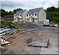
New houses, Heolgerrig, Merthyr Tydfil
Located near the western edge of Heolgerrig, set back from the main road.
Image: © Jaggery Taken: 13 Jun 2012
0.19 miles
3
Heolgerrig bus shelter near the end of the route from Merthyr Tydfil bus station
The shelter is one stop away from the terminus ahead. The route from the centre of Merthyr Tydfil is mostly uphill. This shelter is at an elevation of about 290 metres (about 950 feet) above mean sea level.
Image: © Jaggery Taken: 13 Jun 2012
0.20 miles
4
Heolgarrig houses NE of Beechwood Drive, Heolgerrig, Merthyr Tydfil
Heolgerrig is the name both of a district of Merthyr Tydfil and the main road through it.
Image: © Jaggery Taken: 13 Jun 2012
0.20 miles
5
Gernant Lane, Heolgerrig, Merthyr Tydfil
Gernant Lane heads SW away from Heolgerrig towards an area of former coal tips that are being reclaimed by nature.
Image: © Jaggery Taken: 13 Jun 2012
0.22 miles