
IMAGES TAKEN NEAR TO
Winchfawr, MERTHYR TYDFIL, CF48 1RD
Introduction
This page details the photographs taken nearby to Winchfawr, CF48 1RD by members of the Geograph project.
The Geograph project started in 2005 with the aim of publishing, organising and preserving representative images for every square kilometre of Great Britain, Ireland and the Isle of Man.

There are currently over 7.5m images from over14,400 individuals and you can help contribute to the project by visiting https://www.geograph.org.uk
Image Map
Images are licensed for reuse under creativecommons.org/licenses/by-sa/2.0
Notes
- Clicking on the map will re-center to the selected point.
- The higher the marker number, the further away the image location is from the centre of the postcode.
Image Listing (5 Images Found)
Images are licensed for reuse under creativecommons.org/licenses/by-sa/2.0
Image
Details
Distance
1
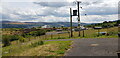
Winch Fawr
Now a peaceful landscape with expansive views, but the landscape here is scarred by intensive coal working in times gone by.
Image: © Paul Collins
Taken: 6 Jul 2023
0.02 miles
2
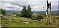
Winch Fawr
Now a peaceful landscape with expansive views, but the landscape here is scarred by intensive coal working in times gone by.
Image: © Paul Collins
Taken: 6 Jul 2023
0.04 miles
3
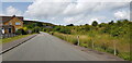
Winch Fawr Road
This is a peaceful place with housing and areas of open land, with expansive views. But a glance at an old Ordnance Survey map shows that the landscape here was once full of industrial activity, principally coal workings.
Image: © Paul Collins
Taken: 6 Jul 2023
0.17 miles
4
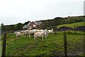
Winch Fawr
Farm on the eastern slopes of Mynydd Aberdare.
Image: © Graham Horn
Taken: 5 Oct 2008
0.19 miles
5
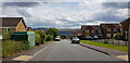
Winch Fawr Road
Modern housing on the site of former coal workings.
Image: © Paul Collins
Taken: 6 Jul 2023
0.25 miles