IMAGES TAKEN NEAR TO
Dragon Parc, MERTHYR TYDFIL, CF48 1PQ

Introduction

This page details the photographs taken nearby to Dragon Parc, CF48 1PQ by members of the Geograph project.

The Geograph project started in 2005 with the aim of publishing, organising and preserving representative images for every square kilometre of Great Britain, Ireland and the Isle of Man.

There are currently over 7.5m images from over14,400 individuals and you can help contribute to the project by visiting https://www.geograph.org.uk

Image Map


Images are licensed for reuse under creativecommons.org/licenses/by-sa/2.0
Notes
  • Clicking on the map will re-center to the selected point.
  • The higher the marker number, the further away the image location is from the centre of the postcode.

Image Listing (29 Images Found)

Images are licensed for reuse under creativecommons.org/licenses/by-sa/2.0
  • ...
Image
Details
Distance
1
Taff Trail between Abercanaid and Upper Abercanaid
Image: © David Smith Taken: 17 Sep 2022
0.05 miles
2
Greensquares name sign, Abercanaid
Alongside the access road to this https://www.geograph.org.uk/photo/6088817 site.
Image: © Jaggery Taken: 27 Feb 2019
0.05 miles
3
Entrance to the Greensquares site, Abercanaid
The Greensquares name sign https://www.geograph.org.uk/photo/6088823 near the camera shows The Ultimate Outdoor Living Space.
Image: © Jaggery Taken: 27 Feb 2019
0.05 miles
4
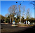
Tall lamppost in Upper Abercanaid
On a mini-roundabout near Lewis Square.
Image: © Jaggery Taken: 27 Feb 2019
0.06 miles
5
Path approaching Graig Road
The path is part of National Cycle Network route 8.
Image: © DS Pugh Taken: 24 Jun 2024
0.07 miles
6
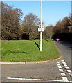
Speed limit reminder on an Abercanaid corner
The non-standard sign shows 30 mph speed limit still applies. A standard 30mph speed limit sign would have conveyed the same message.
Image: © Jaggery Taken: 27 Feb 2019
0.07 miles
7
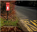
Queen Elizabeth II postbox near Lewis Square, Upper Abercanaid
Located here. https://www.geograph.org.uk/photo/6076406
Image: © Jaggery Taken: 27 Feb 2019
0.08 miles
8
Blue bus shelter near Lewis Square, Upper Abercanaid
Alongside a stop for buses to Merthyr Tydfil.
Image: © Jaggery Taken: 27 Feb 2019
0.09 miles
9
Quay Row, Abercanaid
The ditch in the foreground is line of the Glamorganshire Canal. The original width of the canal can easily be made out.
Image: © Guy Butler-Madden Taken: 24 Feb 2006
0.09 miles
10
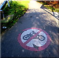
No motorbikes sign on the road in Upper Abercanaid
Near the northeast corner of Lewis Square.
Image: © Jaggery Taken: 27 Feb 2019
0.09 miles
  • ...