
IMAGES TAKEN NEAR TO
Donald Street, MERTHYR TYDFIL, CF48 1NX
Introduction
This page details the photographs taken nearby to Donald Street, CF48 1NX by members of the Geograph project.
The Geograph project started in 2005 with the aim of publishing, organising and preserving representative images for every square kilometre of Great Britain, Ireland and the Isle of Man.

There are currently over 7.5m images from over14,400 individuals and you can help contribute to the project by visiting https://www.geograph.org.uk
Image Map
Images are licensed for reuse under creativecommons.org/licenses/by-sa/2.0
Notes
- Clicking on the map will re-center to the selected point.
- The higher the marker number, the further away the image location is from the centre of the postcode.
Image Listing (89 Images Found)
Images are licensed for reuse under creativecommons.org/licenses/by-sa/2.0
Image
Details
Distance
1

Short row of houses, Newton Street, Abercanaid
On the approach to Abercanaid Community School.
Image: © Jaggery
Taken: 27 Feb 2019
0.03 miles
2

Newton Street descends towards a school, Abercanaid
Towards Abercanaid Community School located on the west bank of the River Taff.
A recreation ground is on the right.
Image: © Jaggery
Taken: 27 Feb 2019
0.03 miles
3
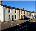
West side of Chapel Street, Abercanaid
Houses on the west side of Chapel Street viewed from the corner of Newton Street.
Image: © Jaggery
Taken: 27 Feb 2019
0.05 miles
4

Children's playground in Abercanaid
In a recreation ground on the west bank of the River Taff viewed from Newton Street.
Image: © Jaggery
Taken: 27 Feb 2019
0.06 miles
5
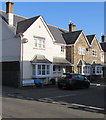
Alexander Court, Abercanaid
Houses at the southwest end of Alexander Place viewed across Chapel Street.
The bilingual name sign on the left shows that Alexander Court is Cwrt Alexander in Welsh,
though the name is usually spelt Alecsander in Welsh (as in Alecsander Fawr (Alexander the Great)).
Image: © Jaggery
Taken: 27 Feb 2019
0.06 miles
6
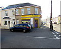
Sanger Stores Abercanaid
Chapel Street convenience store on the corner of Alexander Place.
Image: © Jaggery
Taken: 27 Feb 2019
0.06 miles
7
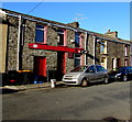
The Richards Arms, Abercanaid
Chapel Street pub opposite Alexander Place.
Image: © Jaggery
Taken: 27 Feb 2019
0.06 miles
8

Low underpass beneath the railway, Pentrebach
Viewed from near an entrance to Pentrebach railway station. The underpass beneath the Merthyr Line railway has a clearance at the top of the arch of about 2 metres (about 6' 7").
A footbridge http://www.geograph.org.uk/photo/3030423 across the River Taff can be seen through the underpass.
Image: © Jaggery
Taken: 5 Jul 2012
0.09 miles
9

River Taff downstream from a footbridge near Pentrebach railway station
Viewed from this http://www.geograph.org.uk/photo/3030423 footbridge.
The Taff here is the boundary between Pentrebach on the left and Abercanaid on the right.
Image: © Jaggery
Taken: 5 Jul 2012
0.09 miles
10

23 miles by rail from Pentrebach to Cardiff
The yellow milepost at the SE end of the platform at Pentrebach railway station shows 23 (miles to the zero milepost in Cardiff Central station).
Pentrebach is on the Merthyr Line. The next station ahead is Troedyrhiw. http://www.geograph.org.uk/photo/2995478
About 2½ km behind the camera is the end of the line at Merthyr Tydfil station. http://www.geograph.org.uk/photo/2995970
Image: © Jaggery
Taken: 5 Jul 2012
0.09 miles