
IMAGES TAKEN NEAR TO
Heol Bryn Man, MERTHYR TYDFIL, CF48 1NE
Introduction
This page details the photographs taken nearby to Heol Bryn Man, CF48 1NE by members of the Geograph project.
The Geograph project started in 2005 with the aim of publishing, organising and preserving representative images for every square kilometre of Great Britain, Ireland and the Isle of Man.

There are currently over 7.5m images from over14,400 individuals and you can help contribute to the project by visiting https://www.geograph.org.uk
Image Map
Images are licensed for reuse under creativecommons.org/licenses/by-sa/2.0
Notes
- Clicking on the map will re-center to the selected point.
- The higher the marker number, the further away the image location is from the centre of the postcode.
Image Listing (4 Images Found)
Images are licensed for reuse under creativecommons.org/licenses/by-sa/2.0
Image
Details
Distance
1
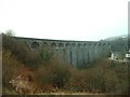
Cefn Coed Viaduct, Merthyr Tydfil
Soon after leaving Merthyr Tydfil the line to Abergavenny and Brecon was carried over the Afon Taff by means of Cefn Coed Viaduct. This magnificent grade 1 listed structure consists of 15 limestone arches, is 115 ft high and now carries the NCN 8 cycleway.
Image: © Ralph Rawlinson
Taken: 27 Nov 2004
0.15 miles
2
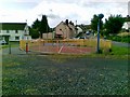
Play area, Heol Bryn-y-Gwyddyl, Merthyr Tydfil
Image: © Alex McGregor
Taken: 10 Jun 2011
0.16 miles
4
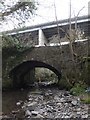
The new overlooks the old
The old stone bridge over the Nant Ffrwd lies in the shadow of the modern dual carriageway of the A470 flying over at a high level. The right hand side (true left bank) of the stream is in the Brecon Beacons National Park - this is truly a forgotten corner of the designated landscape.
Image: © Alan Bowring
Taken: 20 Mar 2014
0.23 miles