
IMAGES TAKEN NEAR TO
Hillside Court, MERTHYR TYDFIL, CF48 1AW
Introduction
This page details the photographs taken nearby to Hillside Court, CF48 1AW by members of the Geograph project.
The Geograph project started in 2005 with the aim of publishing, organising and preserving representative images for every square kilometre of Great Britain, Ireland and the Isle of Man.

There are currently over 7.5m images from over14,400 individuals and you can help contribute to the project by visiting https://www.geograph.org.uk
Image Map
Images are licensed for reuse under creativecommons.org/licenses/by-sa/2.0
Notes
- Clicking on the map will re-center to the selected point.
- The higher the marker number, the further away the image location is from the centre of the postcode.
Image Listing (74 Images Found)
Images are licensed for reuse under creativecommons.org/licenses/by-sa/2.0
Image
Details
Distance
1
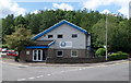
Ash Veterinary Surgery, Merthyr Tydfil
Located in Aberdare Road.
Image: © Jaggery
Taken: 13 Jun 2012
0.01 miles
2
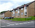
Nant y Gwenith Court, Merthyr Tydfil
Viewed from Heol S O Davies. http://www.geograph.org.uk/photo/3000580
Image: © Jaggery
Taken: 13 Jun 2012
0.06 miles
3
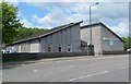
Merthyr RFC clubhouse, Merthyr Tydfil
Located on Dynevor Street opposite the fire station. http://www.geograph.org.uk/photo/3000210
Merthyr Rugby Football Club (nickname The Ironmen) dates its origins to 1876, the year of the first recorded rugby game involving Merthyr, against a side from Brecon.
Image: © Jaggery
Taken: 13 Jun 2012
0.07 miles
4
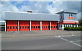
Merthyr Tydfil Fire Station
Viewed across Penry Street. The fire station is located on the west bank of the River Taff. Part of the South Wales Fire and Rescue Service, the fire station serves the main town of Merthyr Tydfil and the villages of Troedyrhiw, Merthyr Vale and Aberfan, with a total population of c57,000. The station has 56 uniformed staff : 4 watches of 10, 15 retained duty system firefighters and the station manager.
Image: © Jaggery
Taken: 13 Jun 2012
0.07 miles
5
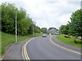
Aberdare Road, Merthyr Tydfil
Aberdare Road climbs away from Dynevor Street. Christ Church is in the distance.
Image: © Jaggery
Taken: 13 Jun 2012
0.08 miles
6

Kirkhouse Nightclub, Merthyr Tydfil
Located in the Kirkhouse Memorial Hall, Dynevor Street, next door to the Three Horse Shoes. http://www.geograph.org.uk/photo/3000326
Image: © Jaggery
Taken: 13 Jun 2012
0.09 miles
7
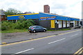
Treads, Dynevor Street, Merthyr Tydfil
Tyre & exhaust centre and MoT centre, located opposite the Three Horse Shoes pub. http://www.geograph.org.uk/photo/3000326
Image: © Jaggery
Taken: 13 Jun 2012
0.09 miles
8
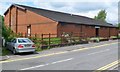
Georgetown Boys and Girls Club, Merthyr Tydfil
The sign on the Dynevor Street building shows established in 1967. However, it was probably not in this building nor with this name at that time, as HRH The Duke of Gloucester opened Georgetown Boys Club, "a new purpose-built club in Merthyr Tydfil" in 1986.
Image: © Jaggery
Taken: 13 Jun 2012
0.09 miles
9
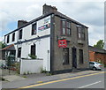
Court of Requests pub, Merthyr Tydfil
The Dynevor Street street pub has a long history. In 1809, a Court of Requests for the recovery of small debts was established here. The court empowered bailiffs to seize the property of debtors, which affected many of the workers made redundant or with reduced wages during the iron industry depression beginning in 1829. As a result the court was hated by many people who saw it as the reason for the loss of their property, and it became a principal target of the Merthyr Rising in 1831. It was broken into by Dic Penderyn, later hanged for his part in the Rising.
Image: © Jaggery
Taken: 13 Jun 2012
0.09 miles
10

Weekes Bros (Merthyr) Ltd, Merthyr Tydfil
Wholesalers' premises in Dynevor Street. On the wall is the logo of Sugro UK, a buying and marketing group.
Image: © Jaggery
Taken: 13 Jun 2012
0.09 miles