1
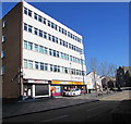
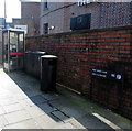
Oldway House, Castle Street, Merthyr Tydfil
Business names in view in February 2019 are Roberts barber shop & ladies' salon and Gloden tanning studio.
Image: © Jaggery
Taken: 27 Feb 2019
0.01 miles
2
Regeneration of the Old Town Hall, Merthyr Tydfil
This June 2012 view shows work in progress on the conversion of the Old Town Hall into an arts and performance venue. The Grade II (star) listed building had been designated "at risk" after having been vacant for more than a decade.
Image: © Jaggery
Taken: 13 Jun 2012
0.01 miles
3
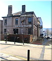
Y Dic Penderyn, Merthyr Tydfil
J.D.Wetherspoon pub on the corner of High Street and Castle Street.
Richard Lewis, better known as Dic Penderyn, was a Welsh labourer and coal miner. During a riot in the 1831 Merthyr Rising, he was arrested and charged with bayonetting a soldier. Many local people doubted his guilt, and many signed a petition for his release. He was found guilty and hanged on August 23rd 1831. He was regarded as a martyr in Merthyr, and across the UK.
Image: © Jaggery
Taken: 13 Jun 2012
0.01 miles
4
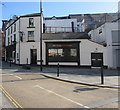
Sovereign Grace Church, Merthyr Tydfil
Sovereign Grace Church is a non-denominational town centre church on the corner of Roberts Lane. The building was formerly Hope Chapel.
In the background is the Old Town Hall. http://www.geograph.org.uk/photo/3000944
Image: © Jaggery
Taken: 13 Jun 2012
0.01 miles
5
Y Dic Penderyn name sign, Merthyr Tydfil
On the wall here. https://www.geograph.org.uk/photo/6169230
Image: © Jaggery
Taken: 27 Feb 2019
0.02 miles
6
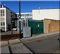
Castle Street electricity substation, Merthyr Tydfil
On the right here https://www.geograph.org.uk/photo/6168951 the green cabinet is a Western Power Distribution electricity substation.
Its identifier is CASTLE ST GPO S/S 55-2942.
Image: © Jaggery
Taken: 27 Feb 2019
0.02 miles
7
Merthyr Tydfil Exchange
The exchange (code SWMT/EX) in Merthyr Tydfil town centre provides broadband and telephone services for about 17,300 residential premises and 680 non-residential premises.
Image: © Jaggery
Taken: 27 Feb 2019
0.03 miles
8
Iron Dragon near Dic Penderyn Square, Merthyr Tydfil
The pub on the corner of Castle Street and Post Office Lane opened in October 2018.
The building is the converted former Taf Fechan Water Supply Board offices.
Image: © Jaggery
Taken: 27 Feb 2019
0.03 miles
9
Y Dic Penderyn pub in Merthyr Tydfil
Wetherspoon pub at 102-103 High Street. Richard Lewis, better known as Dic Penderyn, was a Welsh labourer and coal miner. During a riot in the 1831 Merthyr Rising, he was arrested and charged with bayonetting a soldier. Many local people doubted his guilt, and many signed a petition for his release. He was found guilty and hanged on August 23rd 1831. He was regarded as a martyr in Merthyr, and across the UK. https://www.geograph.org.uk/photo/6169233 to the name sign.
Image: © Jaggery
Taken: 27 Feb 2019
0.03 miles
10
Post Office Lane, Merthyr Tydfil
The bilingual name sign shows that Post Office Lane is Lôn y Llythyrdy in Welsh.
Image: © Jaggery
Taken: 27 Feb 2019
0.03 miles


