1
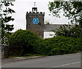
Clock tower at Pandy Farm
A grade II listed building constructed in 1826 in the same style as nearby Cyfarthfa Castle.
Image: © Alan Hughes
Taken: 31 Jul 2020
0.02 miles
2
Clock tower in the SE corner of Pandy Farm, Merthyr Tydfil
Viewed across Cyfarthfa Road.
Image: © Jaggery
Taken: 16 Jun 2014
0.02 miles
3
Pandy Farm, Merthyr Tydfil
Alongside Brecon Road, opposite an entrance http://www.geograph.org.uk/photo/4620803 to Cyfarthfa Park. http://www.geograph.org.uk/photo/4499215 to a view of the tower and clock.
Image: © Jaggery
Taken: 16 Jun 2014
0.02 miles
4
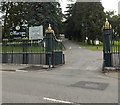
Ornate perimeter railings, Cyfarthfa Park, Merthyr Tydfil
Viewed across Brecon Road towards this http://www.geograph.org.uk/photo/4620803 entrance.
Image: © Jaggery
Taken: 16 Jun 2014
0.02 miles
5
SE entrance to Cyfarthfa Park, Merthyr Tydfil
From Brecon Road. This entrance is for walkers, cyclists and private light vehicles.
There is a 12' 6" width restriction through the gates. A black arrow points left towards an alternative route.
Image: © Jaggery
Taken: 16 Jun 2014
0.02 miles
6
No exit from Cyfarthfa Park, Merthyr Tydfil
Entrance only - follow signs to the western exit.
Image: © Jaggery
Taken: 16 Jun 2014
0.02 miles
7
Brecon Road, Merthyr Tydfil
The A4054 Brecon Road passes the SW edge of Cyfarthfa Park on the right.
Image: © Jaggery
Taken: 16 Jun 2014
0.03 miles
8
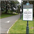
Information board and signpost in Cyfarthfa Park, Merthyr Tydfil
Right for the castle, museum, cafe, miniature railway, tennis and bowls and the main parking area.
Image: © Jaggery
Taken: 16 Jun 2014
0.03 miles
9
Ordnance Survey Cut Mark
This OS cut mark can be found on the wall of Cyfarthfa Park, right of entrance gates. It marks a point 192.202m above mean sea level.
Image: © Adrian Dust
Taken: 5 Nov 2017
0.03 miles
10
Multilingual welcome, Cyfarthfa Park and Museum, Merthyr Tydfil
Welcome in nine languages greets visitors arriving through this http://www.geograph.org.uk/photo/4620803 entrance.
Image: © Jaggery
Taken: 16 Jun 2014
0.04 miles


