1
Brewery Mews, Merthyr Tydfil
On the east side of Vulcan Road.
Image: © Jaggery
Taken: 16 Jun 2014
0.02 miles
2
The Lantern, Merthyr Tydfil
Pub in Cambrian House, Bethesda Street.
Image: © Jaggery
Taken: 16 Jun 2014
0.03 miles
3
Vulcan Court, Merthyr Tydfil
Vulcan Road is on the left. Dating from the early 19th century, Vulcan Court was recently restored.
A blue plaque on the right, near The Lantern pub, http://www.geograph.org.uk/photo/4044982 records that Vulcan House was the home of Matthew John (1806-1888), Chartist, proprietor of Vulcan Iron & Brass Foundry. The last Merthyr Tydfil Chartist, he died in the house on December 16th 1888.
Image: © Jaggery
Taken: 16 Jun 2014
0.04 miles
4
Lawn Terrace, Merthyr Tydfil
Row of four houses opposite Vulcan Court.
Image: © Jaggery
Taken: 16 Jun 2014
0.05 miles
5
Brecon Rd, Merthyr Tydfil
Image: © John Lord
Taken: 1 Feb 2012
0.05 miles
6
Vulcan Road electricity substation, Merthyr Tydfil
Located opposite Brewery Mews, http://www.geograph.org.uk/photo/4044987 the Western Power Distribution electricity
substation has the identifier VULCAN ROAD MERTHYR S/S 552917.
Image: © Jaggery
Taken: 16 Jun 2014
0.05 miles
7
Nisa Local, Merthyr Tydfil
Convenience store on the corner of Brecon Road and Vulcan Road.
Image: © Jaggery
Taken: 16 Jun 2014
0.06 miles
8
Ordnance Survey Cut Mark
This OS cut mark can be found on the wall of St Mary's Church. It marks a point 187.999m above mean sea level.
Image: © Adrian Dust
Taken: 13 Jun 2015
0.06 miles
9
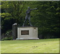
Statue of Eddie Thomas, Merthyr Tydfil
Image: © Ian S
Taken: 26 May 2014
0.07 miles
10
Tabernacle Baptist Chapel, Merthyr Tydfil
Viewed across Brecon Road. The original chapel was erected in 1835, rebuilt in 1842.
The building seen here is the second rebuild, in 1896, in the Romanesque style. Grade II listed in 1988.
Image: © Jaggery
Taken: 16 Jun 2014
0.07 miles


