1
Ordnance Survey Cut Mark
This OS cut mark can be found on the wall of St Mary's Church. It marks a point 187.999m above mean sea level.
Image: © Adrian Dust
Taken: 13 Jun 2015
0.03 miles
2
Ordnance Survey Cut Mark
This OS cut mark can be found on the steps wall leading to Abermorlais Terrace. It marks a point 189.857m above mean sea level.
Image: © Adrian Dust
Taken: 13 Jun 2015
0.05 miles
3
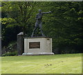
Statue of Eddie Thomas, Merthyr Tydfil
Image: © Ian S
Taken: 26 May 2014
0.07 miles
4
Brewery Mews, Merthyr Tydfil
On the east side of Vulcan Road.
Image: © Jaggery
Taken: 16 Jun 2014
0.07 miles
5
Former Drill Hall - Pont Morlais Road West
Garage premises in dilapidated Great War drill hall.
Image: © John M
Taken: 3 Apr 2015
0.07 miles
6
Fire-damaged building, Bethesda Street, Merthyr Tydfil
On December 28th 2009, fire severely damaged an unoccupied building on Bethesda Street, formerly known as RM’s Rock Club. The two-storey building had been sold earlier in the month to an undisclosed purchaser.
The club holds happy memories for music fans throughout the South Wales valleys, and inspired many musicians over the years. In its heyday, RM’s Rock Club – based in the upstairs nightclub – was the place to be for up and coming bands, who came from far and wide to play to the crowds. But the rock club closed at the end of 2005, because of dwindling public support.
Over the years the downstairs section has had various uses, including Bethesda Brasserie, a Chinese restaurant, and a Fun Pub. The club itself had run under a number of names including Shooters, Barnies, and NV.
Image: © Jaggery
Taken: 21 Apr 2010
0.07 miles
7
Brecon Rd, Merthyr Tydfil
Image: © John Lord
Taken: 1 Feb 2012
0.07 miles
8
The Lantern, Merthyr Tydfil
Pub in Cambrian House, Bethesda Street.
Image: © Jaggery
Taken: 16 Jun 2014
0.07 miles
9
Rear of former drill hall - Pont Morlais Road West
Great War drill hall now used as garage premises.
Image: © John M
Taken: 3 Apr 2015
0.08 miles
10
Lawn Terrace, Merthyr Tydfil
Row of four houses opposite Vulcan Court.
Image: © Jaggery
Taken: 16 Jun 2014
0.08 miles


