1
The Lantern, Merthyr Tydfil
Pub in Cambrian House, Bethesda Street.
Image: © Jaggery
Taken: 16 Jun 2014
0.00 miles
2
Vulcan Court, Merthyr Tydfil
Vulcan Road is on the left. Dating from the early 19th century, Vulcan Court was recently restored.
A blue plaque on the right, near The Lantern pub, http://www.geograph.org.uk/photo/4044982 records that Vulcan House was the home of Matthew John (1806-1888), Chartist, proprietor of Vulcan Iron & Brass Foundry. The last Merthyr Tydfil Chartist, he died in the house on December 16th 1888.
Image: © Jaggery
Taken: 16 Jun 2014
0.01 miles
3
Lawn Terrace, Merthyr Tydfil
Row of four houses opposite Vulcan Court.
Image: © Jaggery
Taken: 16 Jun 2014
0.02 miles
4
Brewery Mews, Merthyr Tydfil
On the east side of Vulcan Road.
Image: © Jaggery
Taken: 16 Jun 2014
0.04 miles
5
The A 4054
The photo was taken from the third floor of a nearby office building.
Image: © Ruth Sharville
Taken: 18 Jun 2009
0.05 miles
6
Vulcan Road electricity substation, Merthyr Tydfil
Located opposite Brewery Mews, http://www.geograph.org.uk/photo/4044987 the Western Power Distribution electricity
substation has the identifier VULCAN ROAD MERTHYR S/S 552917.
Image: © Jaggery
Taken: 16 Jun 2014
0.05 miles
7
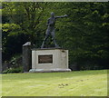
Statue of Eddie Thomas, Merthyr Tydfil
Image: © Ian S
Taken: 26 May 2014
0.06 miles
8
Ordnance Survey Flush Bracket (S1228)
This OS Flush Bracket can be found on the Eagle Inn, Quarry Row. It marks a point 173.862m above mean sea level.
Image: © Adrian Dust
Taken: 26 Jul 2020
0.06 miles
9
Eagle Inn electricity substation in Merthyr Tydfil
The ID label on an electricity substation is sometimes useful in identifying a neighbouring building where the usage has changed. Such is the case here. This Western Power Distribution electricity substation has the identifier EAGEL (a typo for EAGLE) INN MERTHYR S/S 552918 which helped
in the identification of this http://www.geograph.org.uk/photo/4044998 building,
Image: © Jaggery
Taken: 16 Jun 2014
0.07 miles
10
Former Eagle Inn, Merthyr Tydfil
On the corner of Quarry Road and Vincent Place. Converted to residential use, the building retains the bracket that used to support the Eagle name sign, on the wall between upstairs windows.
Image: © Jaggery
Taken: 16 Jun 2014
0.07 miles


