1
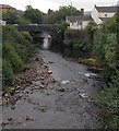
River Taff between two bridges, Merthyr Tydfil
Viewed from Bethesda Street on Jackson's Bridge looking upstream along the Taff towards the A4102 bridge.
Image: © Jaggery
Taken: 13 Jun 2012
0.02 miles
2
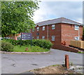
The Wellington Brasserie, Merthyr Tydfil
Located at 1 Bethesda Street, on the bank of the River Taff, adjacent to Jackson's Bridge.
UPDATE 2014. Now Red Spice restaurant. http://www.geograph.org.uk/photo/4045011
Image: © Jaggery
Taken: 13 Jun 2012
0.02 miles
3
Jackson's Bridge
SE Parapet.
Image: © Adrian Dust
Taken: 13 Jun 2020
0.03 miles
4
Jackson's Bridge, Merthyr Tydfil
Viewed along the River Taff from the A4102. Dating from the early 19th century, the stone bridge
which now carries Bethesda Street over the Taff formerly also carried the Dowlais Tramroad.
Image: © Jaggery
Taken: 16 Jun 2014
0.03 miles
5
Ordnance Survey Cut Mark
This OS cut mark can be found on the SE parapet of Jacksons Bridge. It marks a point 173.132m above mean sea level.
Image: © Adrian Dust
Taken: 26 Jul 2020
0.03 miles
6
Red Spice, Merthyr Tydfil
Bangladeshi and Indian cuisine restaurant at 1 Bethesda Street in the Georgetown
area of Merthyr Tydfil. In June 2012, this building housed The Wellington Brasserie. http://www.geograph.org.uk/photo/3000674
Brown signs on the right point left and right along the Taff Trail, part of National Cycle Network route 8.
Image: © Jaggery
Taken: 16 Jun 2014
0.04 miles
7
The Daffodils Care Home, Georgetown, Merthyr Tydfil
Located at 14 Dynevor Street, the care home has 30 single rooms for dementia and respite care.
Image: © Jaggery
Taken: 13 Jun 2012
0.05 miles
8
River Taff downstream from Jackson's Bridge, Merthyr Tydfil
Dixon Street http://www.geograph.org.uk/photo/3000663 is on the left.
Image: © Jaggery
Taken: 13 Jun 2012
0.05 miles
9
Drill Hall, Bethesda Street, Merthyr Tydfil
A notice on the wall shows ACF Glamorgan Merthyr Detachment. ACF is the Army Cadet Force.
Image: © Jaggery
Taken: 13 Jun 2012
0.05 miles
10
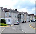
Dixon Street, Merthyr Tydfil
All the houses are on one side of the street, facing the east bank of the River Taff.
Image: © Jaggery
Taken: 13 Jun 2012
0.07 miles


