1
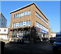
Citizens Advice, Merthyr Tydfil
In Post Office Lane.
Image: © Jaggery
Taken: 27 Feb 2019
0.01 miles
2
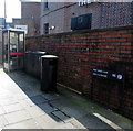
Post Office Lane, Merthyr Tydfil
The bilingual name sign shows that Post Office Lane is Lôn y Llythyrdy in Welsh.
Image: © Jaggery
Taken: 27 Feb 2019
0.01 miles
3
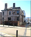
Iron Dragon near Dic Penderyn Square, Merthyr Tydfil
The pub on the corner of Castle Street and Post Office Lane opened in October 2018.
The building is the converted former Taf Fechan Water Supply Board offices.
Image: © Jaggery
Taken: 27 Feb 2019
0.01 miles
4
Dragon depictions, Castle Street, Merthyr Tydfil
Hanging from brackets projecting from
the Iron Dragon pub on the right here. https://www.geograph.org.uk/photo/6168821
Image: © Jaggery
Taken: 27 Feb 2019
0.01 miles
5
Ordnance Survey Cut Mark
This OS cut mark can be found on the front of Taf Fechan Water Supply Board Offices (built 1932). It marks a point 176.114m above mean sea level.
Image: © Adrian Dust
Taken: 13 Jun 2015
0.02 miles
6
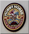
Hobbyhorse sign on the wall of the Winchester Bar, Merthyr Tydfil
Rhymney Brewery sign on the wall here. https://www.geograph.org.uk/photo/3000938
Image: © Jaggery
Taken: 27 Feb 2019
0.02 miles
7
High Street, Merthyr Tydfil
Image: © John Baker
Taken: 28 Mar 2011
0.02 miles
8
Ordnance Survey Cut Mark
This OS cut mark can be found on the NW face of Milbourne Chambers, Post Office Lane. It marks a point 174.827m above mean sea level.
Image: © Adrian Dust
Taken: 13 Jun 2015
0.03 miles
9
Y Dic Penderyn name sign, Merthyr Tydfil
On the wall here. https://www.geograph.org.uk/photo/6169230
Image: © Jaggery
Taken: 27 Feb 2019
0.03 miles
10
Regeneration of the Old Town Hall, Merthyr Tydfil
This June 2012 view shows work in progress on the conversion of the Old Town Hall into an arts and performance venue. The Grade II (star) listed building had been designated "at risk" after having been vacant for more than a decade.
Image: © Jaggery
Taken: 13 Jun 2012
0.03 miles


