1
Ordnance Survey Cut Mark
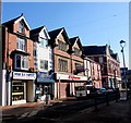
This OS cut mark can be found on the NW face of Milbourne Chambers, Post Office Lane. It marks a point 174.827m above mean sea level.
Image: © Adrian Dust
Taken: 13 Jun 2015
0.01 miles
2
Glebeland Street, Merthyr Tydfil
One-way street in Merthyr Tydfil town centre.
Image: © Jaggery
Taken: 27 Feb 2019
0.01 miles
3
Citizens Advice, Merthyr Tydfil
In Post Office Lane.
Image: © Jaggery
Taken: 27 Feb 2019
0.02 miles
4
The Belle Vue pub in Merthyr Tydfil town centre
At 1 Glebeland Street.
Image: © Jaggery
Taken: 27 Feb 2019
0.02 miles
5
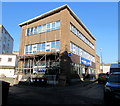
Former Taf Fechan offices, Castle Street, Merthyr Tydfil
Built in 1932 for Taf Fechan Water Board, a public sector undertaking that in 1973 became part of the Welsh National Water Development Authority (later known as the Welsh Water Authority, which was privatised in 1974 to become Welsh Water).
Image: © Jaggery
Taken: 13 Jun 2012
0.02 miles
6
Grade II listed central library and statue, Merthyr Tydfil
The High Street library, now part of Merthyr Tydfil County Borough Council's library service, was built as a Carnegie library, with money donated by Scottish-American businessman and philanthropist Andrew Carnegie. More than 2,500 Carnegie libraries were built worldwide, including 660 in Britain and Ireland.
The inscription on the plinth under the statue is
Henry Seymour Berry, Baron Buckland of Bwlch
Hon. Freeman of the Co. Borough of Merthyr Tydfil.
Born 1877 Died 1928. Erected by Public Subscription.
The library and statue are separately Grade II listed, both in January 1988.
Image: © Jaggery
Taken: 13 Jun 2012
0.02 miles
7
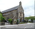
Grade II listed St David's Parish Church, Merthyr Tydfil
Church in Wales church on the corner of High Street and Church Street. Built 1846-1847 as a daughter church to the medieval parish church of St Tydfil. It became the Parish Church in 1968 on the closure of St Tydfil's. Grade II listed in January 1988.
http://www.geograph.org.uk/photo/3002032 to a closeup of the colourful drinking fountain in the foreground.
Image: © Jaggery
Taken: 13 Jun 2012
0.02 miles
8
Commemorative drinking fountain at the entrance to St David's, Merthyr Tydfil
Located at the High Street entrance to the church. http://www.geograph.org.uk/photo/3002011 It was erected to commemorate the marriage of the Prince of Wales (later King Edward VII) on March 10th 1863 to Princess Alexandra of Denmark.
Image: © Jaggery
Taken: 13 Jun 2012
0.02 miles
9
William Smith Building, Merthyr Tydfil
Located in High Street, opposite St David's Parish Church. http://www.geograph.org.uk/photo/3002011
Image: © Jaggery
Taken: 13 Jun 2012
0.02 miles
10
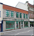
Grade II listed Lloyds TSB, Merthyr Tydfil
Bank branch at 69 High Street, at the northern edge of the pedestrianised area of central Merthyr Tydfil. Grade II listed in January 1988.
Image: © Jaggery
Taken: 13 Jun 2012
0.02 miles


