1
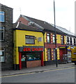
Ordnance Survey Cut Mark
This OS cut mark can be found on the Ex-Servicemen's Club. It marks a point 163.790m above mean sea level.
Image: © Adrian Dust
Taken: 5 Nov 2017
0.04 miles
2
Railway SSE of Merthyr Tydfil railway station
This is the single-track Merthyr branch of the Merthyr Line. Next station ahead is Pentre-bach. https://www.geograph.org.uk/photo/6084163
Image: © Jaggery
Taken: 1 Mar 2019
0.05 miles
3
Farmfoods shop in Merthyr Tydfil
Set back from Court Street.
Image: © Jaggery
Taken: 1 Mar 2019
0.06 miles
4
Jen Chang takeaway, Merthyr Tydfil
Located at 15, Lower High Street. Chinese and English meals to take away.
Image: © Jaggery
Taken: 13 Jun 2012
0.07 miles
5
Merthyr TVR railway station (site), Mid Glamorgan
Opened in 1841 by the Taff Vale Railway as the terminus of its line from Cardiff via Pontypridd, this station closed to passengers in 1877 when services were transferred to Merthyr High Street station, near the current Merthyr Tydfil railway station. It stayed open however as Plymouth Street Goods station until 1968.
View northwest towards the buffers, which were under an overall roof at one time. It had become the inevitable supermarket and carpark when this image was taken.
Image: © Nigel Thompson
Taken: 12 Apr 2024
0.07 miles
6
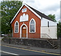
Jerusalem Elim Pentecostal Church, Merthyr Tydfil
The Welsh text in a tablet on the Court Street building shows that it was built in 1911 as a Baptist chapel.
Image: © Jaggery
Taken: 13 Jun 2012
0.07 miles
7
Merthyr Tydfil Labour Club
Set back from Court Street. The advertising hoarding on the right is at the edge of a Merthyr Line railway bridge.
Image: © Jaggery
Taken: 13 Jun 2012
0.07 miles
8
Grade II listed The Court House, Merthyr Tydfil
Located in Court Street. The Court House was built in 1717. Various later modifications and alterations have resulted in little of the original structure remaining. Grade II listed in November 1951.
Image: © Jaggery
Taken: 13 Jun 2012
0.07 miles
9
NE side of Court Street railway bridge, Merthyr Tydfil
The bridge is located about 130 metres from Merthyr Tydfil railway station. http://www.geograph.org.uk/photo/2995949
Behind the bridge on the right is Jerusalem Elim Pentecostal Church. http://www.geograph.org.uk/photo/2997860
Image: © Jaggery
Taken: 13 Jun 2012
0.07 miles
10
SW side of Court Street railway bridge, Merthyr Tydfil
The bridge is located about 130 metres from Merthyr Tydfil railway station. http://www.geograph.org.uk/photo/2995949
Behind the bridge on the right is Grade II listed The Court House. http://www.geograph.org.uk/photo/2997885
Image: © Jaggery
Taken: 13 Jun 2012
0.07 miles


