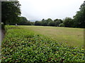
IMAGES TAKEN NEAR TO
Vernon Close, MERTHYR TYDFIL, CF47 0HY
Introduction
This page details the photographs taken nearby to Vernon Close, CF47 0HY by members of the Geograph project.
The Geograph project started in 2005 with the aim of publishing, organising and preserving representative images for every square kilometre of Great Britain, Ireland and the Isle of Man.

There are currently over 7.5m images from over14,400 individuals and you can help contribute to the project by visiting https://www.geograph.org.uk
Image Map
Images are licensed for reuse under creativecommons.org/licenses/by-sa/2.0
Notes
- Clicking on the map will re-center to the selected point.
- The higher the marker number, the further away the image location is from the centre of the postcode.
Image Listing (7 Images Found)
Images are licensed for reuse under creativecommons.org/licenses/by-sa/2.0
Image
Details
Distance
2
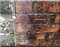
Ordnance Survey Cut Mark
This OS cut mark can be found on the wall of No1 Edward Close. It marks a point 254.621m above mean sea level.
Image: © Adrian Dust
Taken: 12 Mar 2021
0.07 miles
3
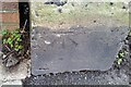
Ordnance Survey Cut Mark
This OS cut mark can be found on the wall junction east side of the road. It marks a point 233.260m above mean sea level.
Image: © Adrian Dust
Taken: 12 Mar 2021
0.20 miles
4
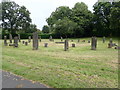
Gorsedd Stone Circle, Merthyr Tydfil
Off Queen's Road, opposite Thomastown Park Recreation Ground.
Image: © Eirian Evans
Taken: 22 Jul 2019
0.22 miles
5
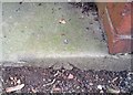
Ordnance Survey Rivet
This OS rivet can be found on the entrance step to Park Side House. It marks a point 220.870m above mean sea level.
Image: © Adrian Dust
Taken: 29 Oct 2017
0.23 miles
6
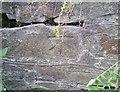
Ordnance Survey Cut Mark
This OS cut mark can be found on the wall SE side of Queens Road. It marks a point 225.528m above mean sea level.
Image: © Adrian Dust
Taken: 26 Jul 2020
0.23 miles