
IMAGES TAKEN NEAR TO
Bedlinog, TREHARRIS, CF46 6UE
Introduction
This page details the photographs taken nearby to CF46 6UE by members of the Geograph project.
The Geograph project started in 2005 with the aim of publishing, organising and preserving representative images for every square kilometre of Great Britain, Ireland and the Isle of Man.

There are currently over 7.5m images from over14,400 individuals and you can help contribute to the project by visiting https://www.geograph.org.uk
Image Map
Images are licensed for reuse under creativecommons.org/licenses/by-sa/2.0
Notes
- Clicking on the map will re-center to the selected point.
- The higher the marker number, the further away the image location is from the centre of the postcode.
Image Listing (20 Images Found)
Images are licensed for reuse under creativecommons.org/licenses/by-sa/2.0
Image
Details
Distance
1
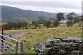
Penddeugae Fach
A hill farm overlooking the Taff valley above Troedrhiw.
Image: © Graham Horn
Taken: 5 Oct 2008
0.02 miles
2
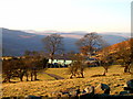
Penddeugae Fach Farm
Penddeugae Fach and its neighbour the now ruined Penddeugae Fawr nestle in the col between Mynydd Gilfach Yr Encil to the North and Mynydd Y Capel to the south,
The Brecon Beacons can be seen in the far distance
Image: © nantcoly
Taken: 23 Nov 2005
0.05 miles
3
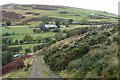
Penddeugae Fach
A hill farm between the Mynydd y Capel (behind us) and Mynydd Cilfach-yr-encil, on the watershed between the Taff and Bargod valleys.
Image: © Graham Horn
Taken: 5 Oct 2008
0.08 miles
4
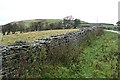
Road to Mynydd Cilfach-yr-encil
One of those roads that climbs up out of the valley to a hill farm, and continues as a track across the summit of the moorland. This is known locally as "the Parish Road" as it follows the boundary of the civil parish.
Image: © Graham Horn
Taken: 5 Oct 2008
0.09 miles
5
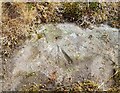
Ordnance Survey Rivet
This damaged OS rivet can be found on a rock to the NE of the track. It marks a point 352.776m above mean sea level.
Image: © Adrian Dust
Taken: 21 Jul 2018
0.10 miles
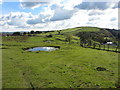
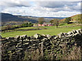
8
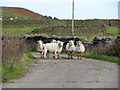
Sheep on the road near Penddeugae-fach
Image: © Gareth James
Taken: 21 Oct 2016
0.11 miles
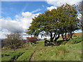
10
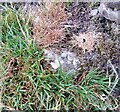
Ordnance Survey Rivet
This OS rivet can be found on a rock at the base of the wall. It marks a point 342.885m above mean sea level.
Image: © Adrian Dust
Taken: 21 Jul 2018
0.17 miles