1
Houses on the east side of High Street, Bedlinog
This part of the B4255 High Street is north of Chapel Street and Muriel Terrace.
Image: © Jaggery
Taken: 22 Feb 2019
0.01 miles
2
The Station Hotel, Bedlinog
Image: © John Lord
Taken: 17 Jul 2010
0.01 miles
3
High Street scaffolding, Bedlinog
On the house on the corner of Station Terrace in February 2019.
Image: © Jaggery
Taken: 22 Feb 2019
0.01 miles
4
Black bilingual plaque on Moriah Chapel, Bedlinog
The Merthyr Tydfil Heritage Trust plaque in Welsh and English is on the wall on the right here. https://www.geograph.org.uk/photo/6067281
Image: © Jaggery
Taken: 22 Feb 2019
0.02 miles
5
Moriah, Bedlinog
High Street side of Moriah chapel on the corner of Chapel Street. Welsh text on the building records that this is the second rebuild (1901) of the 1876 rebuild of Moriah Independent chapel. The original chapel was erected in 1870.
Image: © Jaggery
Taken: 22 Feb 2019
0.02 miles
6
Former Station Hotel, High Street, Bedlinog
In February 2019 the name remains on the former hotel located opposite Station Terrace.
Image: © Jaggery
Taken: 22 Feb 2019
0.02 miles
7
Entrance to the Gibbons Coaches yard, Bedlinog
From High Street near the corner of Station Terrace.
The sign on the gate on the right shows Gibbons Holidays Booking Office.
Image: © Jaggery
Taken: 22 Feb 2019
0.02 miles
8
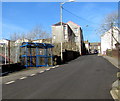
Blue bus shelter, High Street, Bedlinog
Alongside a stop on bus route 79 from Merthyr Tydfil bus station to Bedlinog
via Troedyrhiw, Merthyr Vale, Treharris and Taff Merthyr Garden Village.
Image: © Jaggery
Taken: 22 Feb 2019
0.03 miles
9
Single-track railway line east of High Street, Bedlinog
Viewed from this https://www.geograph.org.uk/photo/6069444 High Street bridge in February 2019. The route has been freight-only since the closure of nearby Bedlinog railway station in 1964.
Image: © Jaggery
Taken: 22 Feb 2019
0.03 miles
10
Ordnance Survey Cut Mark
This OS cut mark can be found on the east parapet of the railway bridge. It marks a point 248.342m above mean sea level.
Image: © Adrian Dust
Taken: 7 Oct 2018
0.03 miles


