1
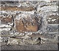
Ordnance Survey Cut Mark
This OS cut mark can be found on No23 Pleasant View. It marks a point 311.265m above mean sea level.
Image: © Adrian Dust
Taken: 7 Oct 2018
0.04 miles
2
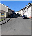
Steep ascent, Lewis Street, Bedlinog
Lewis Street ascends from George Street towards Upper High Street and Pleasant View.
Image: © Jaggery
Taken: 25 Feb 2019
0.07 miles
3
Bedlinog town from above Craig Penddeugae
Aerial Photograph taken from a hangglider looking down on my house in the village of Bedlinog (note this picture was taken in 1992 prior to the demolition of Taff Merthyr Colliery that can be just seen down the valley from Bedlinog)
Image: © nantcoly
Taken: Unknown
0.08 miles
4
Terraced houses on a steep hill, Bedlinog
Lewis Street.
Image: © Robin Drayton
Taken: 12 Jul 2012
0.08 miles
5
Brick building in a recreation area north of George Street, Bedlinog
A football pitch is about 250 metres behind the camera, so perhaps this building is used as changing rooms.
Image: © Jaggery
Taken: 25 Feb 2019
0.09 miles
6
Dry stream bed in Bedlinog
No water is visible in this view of the brook/stream Nant Llwynog on February 25th 2019 during a period of record-breaking winter warmth. The maximum temperature of 20.6 Celsius (69F) at Trawsgoed, Ceredigion today is the highest air temperature ever measured in Wales in February, and the first time a temperature above 20 degrees Celsius (68F) has been recorded in Wales (and the UK) in winter.
Image: © Jaggery
Taken: 25 Feb 2019
0.10 miles
7
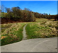
Path towards woods, Bedlinog
Above the brook/stream Nant Llwynog (on the right) a minor tributary of Bargod Taf.
Image: © Jaggery
Taken: 25 Feb 2019
0.10 miles
8
Six lockup garages, George Street, Bedlinog
Near the corner of Lewis Street.
Image: © Jaggery
Taken: 25 Feb 2019
0.11 miles
9
Waste ground in Bedlinog
Viewed from Bedlinog Terrace looking towards Old Quarry Lane.
Image: © Jaggery
Taken: 25 Feb 2019
0.12 miles
10
Craig-yr-Hendre, Bedlinog
Viewed across George Street in February 2019. Managed by Hafod Housing Association,
Craig-yr-Hendre is retirement housing containing 20 flats built in 1990.
Image: © Jaggery
Taken: 25 Feb 2019
0.12 miles


