1
Towards Moriah Street, Bedlinog
Viewed from the southeast end of Bedw Road looking across a railway bridge towards houses in Moriah Street.
Image: © Jaggery
Taken: 22 Feb 2019
0.01 miles
2
Wren Living van, Moriah Street, Bedlinog
Wren Living Limited (formerly Wren Kitchens Limited) is based in
The Nest, Falkland Way, Barton-upon-Humber, North Lincolnshire.
Image: © Jaggery
Taken: 22 Feb 2019
0.02 miles
3
Old-style road sign, Moriah Street, Bedlinog
Viewed in February 2019. The pre-Worboys sign shows DOUBLE BEND.
Image: © Jaggery
Taken: 22 Feb 2019
0.02 miles
4
Weak bridge/Pont Wan, Bedlinog
The English/Welsh sign faces Moriah Street on the approach to this https://www.geograph.org.uk/photo/6067492 bridge over a railway.
The sign shows 7.5 T m g w, indicating 7.5 tonnes mean gross weight (the maximum legally permitted weight of a vehicle, including fuel, load, driver, passengers etc)
Image: © Jaggery
Taken: 22 Feb 2019
0.02 miles
5
Bedlinog Exchange
BT site on the corner of Moriah Street and High Street viewed in February 2019.
Bedlinog Exchange (identifier SWQOE) serves about 665 residential premises and
15 non-residential premises in Bedlinog.
Image: © Jaggery
Taken: 22 Feb 2019
0.03 miles
6
The Old School, Bedlinog
High Street side of the building dated 1897 on the corner of Graig Terrace.
Image: © Jaggery
Taken: 25 Feb 2019
0.03 miles
7
Weak bridge 100 yards ahead, Moriah Street, Bedlinog
The sign on the corner of High Street is on the approach to this https://www.geograph.org.uk/photo/6067494 weak bridge.
The text is also in Welsh.
Image: © Jaggery
Taken: 22 Feb 2019
0.03 miles
8
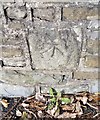
Ordnance Survey Cut Mark
This OS cut mark can be found on the old school wall west side of Upper High Street. It marks a point 271.802m above mean sea level.
Image: © Adrian Dust
Taken: 7 Oct 2018
0.03 miles
9
Junction of Moriah Street and High Street, Bedlinog
From the left, Moriah Street joins High Street. This junction is the northern start/end of the B4255
which extends behind the camera for 7 km to Nelson. High Street ahead is unclassified.
Image: © Jaggery
Taken: 22 Feb 2019
0.03 miles
10
The Last Coal through Bedlinog
The final coal working from Cwmbargoed passes through the village of Bedlinog on its way to Margam.
Image: © Gareth James
Taken: 23 Feb 2024
0.04 miles


