IMAGES TAKEN NEAR TO
Llanfabon, Nelson, TREHARRIS, CF46 6PG
Introduction
This page details the photographs taken nearby to CF46 6PG by members of the Geograph project.
The Geograph project started in 2005 with the aim of publishing, organising and preserving representative images for every square kilometre of Great Britain, Ireland and the Isle of Man.

There are currently over 7.5m images from over14,400 individuals and you can help contribute to the project by visiting https://www.geograph.org.uk
Image Map
Images are licensed for reuse under creativecommons.org/licenses/by-sa/2.0
Notes
- Clicking on the map will re-center to the selected point.
- The higher the marker number, the further away the image location is from the centre of the postcode.
Image Listing (16 Images Found)
Images are licensed for reuse under creativecommons.org/licenses/by-sa/2.0
Image
Details
Distance
1
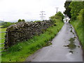
Country Lane, Llanfabon
Lined by a drystone dyke, this is one of five lanes converging on the hilltop where there are a church and inn.
Image: © Colin Smith
Taken: 27 May 2007
0.06 miles
2
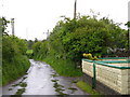
Narrow Lane out of Llanfabon
Hedgerow-lined lane leading east from Pengelli to Bryntaldwyn and Nelson.
Image: © Colin Smith
Taken: 27 May 2007
0.07 miles
3
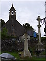
St Mabon's Church, Llanfabon
This isolated stone church with Norman arched doorway is located on a ridgetop with five lanes radiating from it.
Image: © Colin Smith
Taken: 27 May 2007
0.07 miles
4
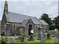
Church of St Mabon
For more information: https://coflein.gov.uk/en/site/303261/
Image: © Alan Hughes
Taken: 26 Aug 2021
0.09 miles
5
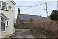
St Mabon's Church, Llanfabon
This Grade II listed rebuilt Victorian stone church with a roof of Welsh slate is almost opposite the Llanfabon Inn, left. The Rhymney Valley Ridgeway Walk comes up the road and turns right at the T-junction on to Ty Du Road Image
Image: © M J Roscoe
Taken: 24 Mar 2018
0.09 miles
6
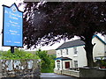
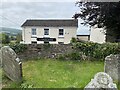
Llanfabon
A small hamlet on the Rhymney Valley Ridgeway, reachable by twisting lanes and paths. The inn is at the junction of three lanes while the church has two graveyards, on each side of its lane.
Image: © Colin Smith
Taken: 27 May 2007
0.10 miles
7
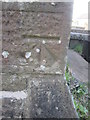
Ordnance Survey Cut Mark
This OS cut mark can be found on the north face of St Mabon's Church. It marks a point 212.827m above mean sea level.
Image: © Adrian Dust
Taken: 23 Apr 2016
0.10 miles
8
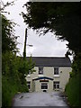
The Llanfabon Inn
A welcoming sight at the top of a winding lane is this old stone-built inn.
Image: © Colin Smith
Taken: 27 May 2007
0.10 miles
9
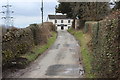
Ty Du Road to Llanfabon
The inn Image is at the road junction at the end of the country lane which here is part of the Rhymney Valley Ridgeway Walk.
Image: © M J Roscoe
Taken: 24 Mar 2018
0.10 miles