1
Sunlight and shadow; sheep, trees and pasture
Image: © John Lord
Taken: 29 Sep 2015
0.05 miles
2
Track to Maesmafon Farm near Nelson
Viewed from Pentwyn Road, just west of the edge of residential Nelson.
Image: © Jaggery
Taken: 17 Mar 2011
0.09 miles
3
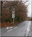
Give way to oncoming vehicles, Bwl Road, Nelson
Vehicles should stop behind the broken white lines if a vehicle is approaching.
The sign text is in English and Welsh.
Image: © Jaggery
Taken: 20 Dec 2018
0.12 miles
4
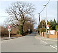
Nelson crossroads
The crossroads of Llwyncelyn Terrace (camera side), High Street (on the right),
Pentwyn Road (on the left) and Bwl Road (ahead) at the western edge of Nelson.
Image: © Jaggery
Taken: 22 Dec 2018
0.14 miles
5
Houses at the western edge of High Street Nelson
Viewed from the edge of the Bwl Road / Pentwyn Road / Llwyncelyn Terrace crossroads.
Image: © Jaggery
Taken: 17 Mar 2011
0.15 miles
6
Bungalows at the western edge of Nelson
Bungalows on the corner of Llwyncelyn Terrace and Pentwyn Road, opposite the Hollybush pub. http://www.geograph.org.uk/photo/2362170
Image: © Jaggery
Taken: 17 Mar 2011
0.15 miles
7
Bwl Road, Nelson
Viewed from the crossroads of High Street, Llwyncelyn Terrace and Pentwyn Road, at the western edge of Nelson.
Image: © Jaggery
Taken: 17 Mar 2011
0.15 miles
8
Bungalows at the western edge of Nelson
On the corner of Llwyncelyn Terrace and Pentwyn Road near the western end of High Street.
Image: © Jaggery
Taken: 20 Dec 2018
0.15 miles
9
We are fully booked for food, Hollybush, Nelson
The board is outside the Hollybush https://www.geograph.org.uk/photo/6006001 on December 22nd 2018, the last Saturday before Christmas.
Image: © Jaggery
Taken: 22 Dec 2018
0.15 miles
10
Hollybush, Llwyncelyn Terrace, Nelson
Pub on the corner of High Street. Llwyncelyn is Welsh for Hollybush. https://www.geograph.org.uk/photo/6006006 to the name sign.
Image: © Jaggery
Taken: 22 Dec 2018
0.15 miles


