IMAGES TAKEN NEAR TO
Lon-y-Celyn, TREHARRIS, CF46 6HT

Introduction

This page details the photographs taken nearby to Lon-y-Celyn, CF46 6HT by members of the Geograph project.

The Geograph project started in 2005 with the aim of publishing, organising and preserving representative images for every square kilometre of Great Britain, Ireland and the Isle of Man.

There are currently over 7.5m images from over14,400 individuals and you can help contribute to the project by visiting https://www.geograph.org.uk

Image Map


Images are licensed for reuse under creativecommons.org/licenses/by-sa/2.0
Notes
  • Clicking on the map will re-center to the selected point.
  • The higher the marker number, the further away the image location is from the centre of the postcode.

Image Listing (86 Images Found)

Images are licensed for reuse under creativecommons.org/licenses/by-sa/2.0
  • ...
Image
Details
Distance
1
Allotments, Nelson
Image: © John Lord Taken: 21 Aug 2015
0.07 miles
2
Allotments, Nelson
Image: © John Lord Taken: 29 Sep 2015
0.08 miles
3
Nelson RFC grandstand
The grandstand is located on the opposite side of the pitch to the clubhouse. http://www.geograph.org.uk/photo/2356560
Image: © Jaggery Taken: 17 Mar 2011
0.08 miles
4
Entrance to allotments, Nelson
Image: © John Lord Taken: 21 Aug 2015
0.09 miles
5
Shingrig Road Allotments entrance gate, Nelson
Set back 35 metres from the B4255 Shingrig Road.
Image: © Jaggery Taken: 17 Dec 2018
0.10 miles
6
Sheep grazing, Nelson
Image: © John Lord Taken: 29 Sep 2015
0.10 miles
7
Northern end of Bwl Road, Nelson
The view south from opposite The Star Club. http://www.geograph.org.uk/photo/2426191 The southern end of Bwl Road http://www.geograph.org.uk/photo/2363483 is about 750 metres away.
Image: © Jaggery Taken: 24 May 2011
0.11 miles
8
Nelson RFC clubhouse
The clubhouse is located at the eastern edge of the club's ground, The Parc, which is set back from Shingrig Road. Nelson Rugby Football Club was founded in 1934. The team's nickname is The Unicorns and a unicorn is prominent in the club's badge, which can be seen on the clubhouse name sign.
Image: © Jaggery Taken: 17 Mar 2011
0.11 miles
9
Ordnance Survey Cut Mark
This OS cut mark can be found on the gatepost of No110 Shingrig Road. It marks a point 148.584m above mean sea level.
Image: © Adrian Dust Taken: 25 May 2019
0.11 miles
10
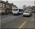
X38 bus, Shingrig Road, Nelson
N.A.T. Group bus travelling southeastwards on the B4255 Shingrig Road towards Nelson bus station on bus route X38 from Bargoed to Pontypridd bus station.
Image: © Jaggery Taken: 5 Jan 2019
0.12 miles
  • ...