
IMAGES TAKEN NEAR TO
Fernhill Terrace, TREHARRIS, CF46 5NA
Introduction
This page details the photographs taken nearby to Fernhill Terrace, CF46 5NA by members of the Geograph project.
The Geograph project started in 2005 with the aim of publishing, organising and preserving representative images for every square kilometre of Great Britain, Ireland and the Isle of Man.

There are currently over 7.5m images from over14,400 individuals and you can help contribute to the project by visiting https://www.geograph.org.uk
Image Map
Images are licensed for reuse under creativecommons.org/licenses/by-sa/2.0
Notes
- Clicking on the map will re-center to the selected point.
- The higher the marker number, the further away the image location is from the centre of the postcode.
Image Listing (84 Images Found)
Images are licensed for reuse under creativecommons.org/licenses/by-sa/2.0
Image
Details
Distance
1
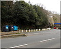
Recycling area, Cardiff Road, Treharris
The recycling bins are near a Gulf filling station. http://www.geograph.org.uk/photo/3915509
Image: © Jaggery
Taken: 27 Mar 2014
0.04 miles
2

Western end of Park Lane, Treharris
Park Lane on the right descends away from the B4254 Cardiff Road.
Image: © Jaggery
Taken: 27 Mar 2014
0.05 miles
3

King George V postbox, Blackbrook, Treharris
Located here. http://www.geograph.org.uk/photo/4044600
Image: © Jaggery
Taken: 27 Mar 2014
0.05 miles
4

Blackbrook, Treharris
Blackbrook is part of the B4254 Cardiff Road. The postbox is from the reign of King George V. http://www.geograph.org.uk/photo/4044607
Image: © Jaggery
Taken: 27 Mar 2014
0.05 miles
5
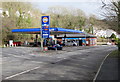
Treharris Service Station, Treharris
Gulf filling station and Mace shop on the north side of the A4054 Cardiff Road viewed in late January 2016.
An August 2011 Google Earth Street View shows a Total filling station here.
Image: © Jaggery
Taken: 30 Jan 2016
0.05 miles
6
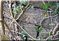
Ordnance Survey Cut Mark
This OS cut mark can be found on the wall at the rear of the garage. It marks a point 146.408m above mean sea level.
Image: © Adrian Dust
Taken: 14 Apr 2018
0.05 miles
7
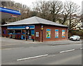
Mace shop, Cardiff Road, Treharris
Alongside a Gulf filling station. http://www.geograph.org.uk/photo/3915509
Image: © Jaggery
Taken: 27 Mar 2014
0.06 miles
8
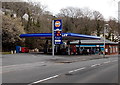
Gulf and Mace in Treharris
Viewed across the A4054 Cardiff Road looking towards a Gulf filling station and Mace shop. http://www.geograph.org.uk/photo/3915515
Image: © Jaggery
Taken: 27 Mar 2014
0.06 miles
9
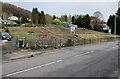
Blackbrook Park development site, Edwardsville
The site is above the north side of the A4054 Cardiff Road, viewed in late January 2016.
The board in the middle of the site states that seven detached houses are to be built here.
Image: © Jaggery
Taken: 30 Jan 2016
0.06 miles
10

Ashgrove houses, Treharris
Viewed along a path on the north side of the B4254 Cardiff Road.
Image: © Jaggery
Taken: 27 Mar 2014
0.06 miles