
IMAGES TAKEN NEAR TO
Pritchard Street, TREHARRIS, CF46 5HS
Introduction
This page details the photographs taken nearby to Pritchard Street, CF46 5HS by members of the Geograph project.
The Geograph project started in 2005 with the aim of publishing, organising and preserving representative images for every square kilometre of Great Britain, Ireland and the Isle of Man.

There are currently over 7.5m images from over14,400 individuals and you can help contribute to the project by visiting https://www.geograph.org.uk
Image Map
Images are licensed for reuse under creativecommons.org/licenses/by-sa/2.0
Notes
- Clicking on the map will re-center to the selected point.
- The higher the marker number, the further away the image location is from the centre of the postcode.
Image Listing (13 Images Found)
Images are licensed for reuse under creativecommons.org/licenses/by-sa/2.0
Image
Details
Distance
1
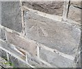
Ordnance Survey Cut Mark
This OS cut mark can be found on No41 Webster Street. It marks a point 163.775m above mean sea level.
Image: © Adrian Dust
Taken: 14 Apr 2018
0.15 miles
2
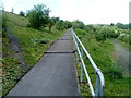
Stepped ramp, Taff Bargoed Millennium Park, Trelewis
The ramp, with shallow steps, ascends away from the west side of a river footbridge. http://www.geograph.org.uk/photo/3221007
Image: © Jaggery
Taken: 24 May 2011
0.16 miles
3
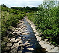
Taff Bargoed upstream from a footbridge, Trelewis
Viewed from this http://www.geograph.org.uk/photo/3221007 footbridge in Taff Bargoed Millennium Park. The Taff Bargoed (Bargod Taf in Welsh) is a tributary of the River Taff, into which it flows at Quakers Yard.
Image: © Jaggery
Taken: 24 May 2011
0.17 miles
4
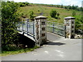
Small footbridge over the Taff Bargoed, Trelewis
The footbridge is about 150 metres upstream (north) of a bigger one. http://www.geograph.org.uk/photo/3220920
The Taff Bargoed (Bargod Taf in Welsh) is a tributary of the River Taff, into which it flows at Quakers Yard.
Image: © Jaggery
Taken: 24 May 2011
0.19 miles
5
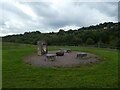
Artwork in Taff Bargoed Park
The sculpture shows a sculpted egg coming out of a sculpted mould
Image: © David Smith
Taken: 27 Sep 2021
0.20 miles
6
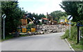
Industrial yard beyond the northern end of Taff Bargoed Millennium Park, Trelewis
A road heads north away from the park towards Cwm-cothi. This scene is a contrast with the greenness of the park behind the camera and the route ahead beyond the yard.
Image: © Jaggery
Taken: 24 May 2011
0.20 miles
7
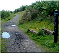
Pony Trek Trail, Trelewis
Viewed near a footbridge http://www.geograph.org.uk/photo/3221007 in Taff Bargoed Millennium Park.
Image: © Jaggery
Taken: 24 May 2011
0.20 miles
8
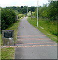
Path through Taff Bargoed Millennium Park, Trelewis
Taff Bargoed Millennium Park is on the site of the former Taff Merthyr and Deep Navigation Collieries.
A stone at the side of the path records the depths of three of the former coal seams:
Number 3 Rhondda 1560ft; Tor Mynydd 1566ft; Blackband 1570ft.
Image: © Jaggery
Taken: 24 May 2011
0.20 miles
9
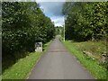
Shared path in Taff Bargoed Park
The marked section of the path marks three coal seams running beneath the park
Image: © David Smith
Taken: 27 Sep 2021
0.20 miles
10
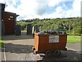
Coal mine truck outside visitor centre, Taff Bargoed Park
Image: © David Smith
Taken: 27 Sep 2021
0.20 miles