1
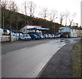
Antrac Motors, Rock Garage, Quakers Yard
New and used light commercial vehicles dealers on the south side of the A4054 Cardiff Road.
Image: © Jaggery
Taken: 30 Jan 2016
0.06 miles
2
Rock Houses, Cardiff Road, Quakers Yard
Row of houses extending to the edge of Antrac Motors in Rock Garage. https://www.geograph.org.uk/photo/5864146
Image: © Jaggery
Taken: 30 Jan 2016
0.07 miles
3
Ordnance Survey Rivet
This OS rivet can be found on the step of No18 Wingfield Terrace. It marks a point 132.756m above mean sea level.
Image: © Adrian Dust
Taken: 7 Oct 2018
0.08 miles
4
Rock Houses
Old terraced houses near Quakers Yard.
Image: © Alan Hughes
Taken: 30 Mar 2021
0.08 miles
5
West along the A4054 Cardiff Road, Quakers Yard
Past Antrac Motors in Rock Garage, and the eastern end of Rock Houses.
Image: © Jaggery
Taken: 30 Jan 2016
0.08 miles
6
Rock Houses, Quakers Yard
Row of houses extending for 30 metres (about 100 feet) along the south side of the A4054 Cardiff Road.
Image: © Jaggery
Taken: 30 Jan 2016
0.09 miles
7
Ordnance Survey Cut Mark
This OS cut mark can be found on the wall next to No5 Rock Houses. It marks a point 112.749m above mean sea level.
Image: © Adrian Dust
Taken: 20 Jul 2020
0.09 miles
8
Ordnance Survey Cut Mark
This OS cut mark can be found on the wall north side of Caerphilly Road. It marks a point 124.386m above mean sea level.
Image: © Adrian Dust
Taken: 7 Oct 2018
0.09 miles
9
Brynheulog Terrace, Quakers Yard
Houses above the south side of the A4054 Cardiff Road.
The rear gardens of these houses are on the north side of Caerphilly Road.
Image: © Jaggery
Taken: 30 Jan 2016
0.11 miles
10
Woodlands Park residential park homes entrance gates, Quakers Yard
At the southern end of Woodlands Crescent, the park homes site is on a bank of the River Taff.
A park home is a detached bungalow-style house, usually in a private estate, as here, located on plots known as pitches. Legally, they are mobile homes and are covered by their own legislation.
Image: © Jaggery
Taken: 30 Jan 2016
0.11 miles


