
IMAGES TAKEN NEAR TO
Pantanas, TREHARRIS, CF46 5BN
Introduction
This page details the photographs taken nearby to Pantanas, CF46 5BN by members of the Geograph project.
The Geograph project started in 2005 with the aim of publishing, organising and preserving representative images for every square kilometre of Great Britain, Ireland and the Isle of Man.

There are currently over 7.5m images from over14,400 individuals and you can help contribute to the project by visiting https://www.geograph.org.uk
Image Map
Images are licensed for reuse under creativecommons.org/licenses/by-sa/2.0
Notes
- Clicking on the map will re-center to the selected point.
- The higher the marker number, the further away the image location is from the centre of the postcode.
Image Listing (116 Images Found)
Images are licensed for reuse under creativecommons.org/licenses/by-sa/2.0
Image
Details
Distance
1
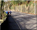
Jogging up from Quakers Yard
Three male joggers ascend the A4054 Cardiff Road pavement from Quakers Yard towards Treharris.
Image: © Jaggery
Taken: 30 Jan 2016
0.03 miles
2
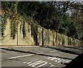
High roadside wall, Treharris
Above the A4054 Cardiff Road which is on a narrow shelf between high
ground to the left and the River Taff below the right side of the road.
Image: © Jaggery
Taken: 30 Jan 2016
0.05 miles
3
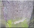
Ordnance Survey Cut Mark
This OS cut mark can be found on the wall SW side of the A4056. It marks a point 119.317m above mean sea level.
Image: © Adrian Dust
Taken: 14 Apr 2018
0.07 miles
5
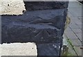
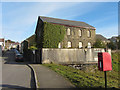
Ordnance Survey Cut Mark
This OS cut mark can be found on No21 Thomas Street. It marks a point 150.879m above mean sea level.
Image: © Adrian Dust
Taken: 14 Apr 2018
0.10 miles
6
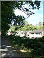
Taff Trail passing houses in Edwardsville
Image: © David Smith
Taken: 17 Sep 2022
0.10 miles
7
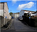
Windsor Place, Treharris
Ascending from the north side of the A4054. Signs show one-way traffic ahead.
Image: © Jaggery
Taken: 30 Jan 2016
0.10 miles
8
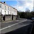
Bend in the A4054, Treharris
The road here is above the north bank of the River Taff.
Double white lines in the middle of the road indicate no overtaking.
Image: © Jaggery
Taken: 30 Jan 2016
0.11 miles
9
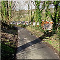
Tram Road Side, Quakers Yard
Looking to the NNW along Tram Road Side from near the Brecon Walk junction.
Image: © Jaggery
Taken: 30 Jan 2016
0.11 miles
10
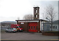
Treharris Fire Station and training tower
Small fire station located on the corner of Thomas Street and Commercial Terrace.
It is part of the South Wales Fire and Rescue Service.
Image: © Jaggery
Taken: 17 Mar 2011
0.11 miles