1
Taff Trail signpost, Quakers Yard
Following the course of the River Taff, the Taff Trail is a walking and cycling route in Wales, extending for about 88km (55 miles) between Brecon and Cardiff Bay. Here, the River Taff is 100 metres behind the camera.
Image: © Jaggery
Taken: 30 Jan 2016
0.01 miles
2
Row of houses, Quakers Yard
On the north side of Goitre Coed Road, opposite Rodericks Terrace.
Image: © Jaggery
Taken: 30 Jan 2016
0.01 miles
3
Tollgate House, Quakers Yard
On the corner of Tram Road Side and Rodericks Terrace.
Image: © Jaggery
Taken: 30 Jan 2016
0.01 miles
4
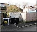
Brecon Walk electricity substation, Quakers Yard
Located here https://www.geograph.org.uk/photo/5864569 the cabinet is Western Power Distribution electricity substation S/S 551861.
Image: © Jaggery
Taken: 30 Jan 2016
0.02 miles
5
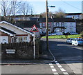
Warning sign - 14% ascent ahead, Quakers Yard
On the corner of Woodlands Crescent and Rodericks Terrace,
on the approach to steep Goitre Coed Road. A 14% gradient is 1 in 7.
Image: © Jaggery
Taken: 30 Jan 2016
0.03 miles
6
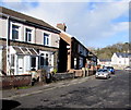
Rodericks Terrace houses, Quakers Yard
The house on the right is on the corner of Woodlands Avenue.
Image: © Jaggery
Taken: 30 Jan 2016
0.03 miles
7
Cafe this way, Quakers Yard
The sign points along a path between Brecon Walk (on the left) and Tram Road Side.
Image: © Jaggery
Taken: 30 Jan 2016
0.03 miles
8
Quakers Yard name sign, Tram Road Side, Quakers Yard
The information board on the left records that this area near the confluence of two rivers, the Taff and the Bargoed Taff, was originally known as Rhyd y Grug, Welsh for Ford of the Rustling Waters. The name changed in the 18th century when a small plot of land was bequeathed to the Quaker movement for use as a Quaker burial ground or yard.
Image: © Jaggery
Taken: 30 Jan 2016
0.03 miles
9
Woodlands Crescent, Quakers Yard
Viewed from the Woodlands Park residential park homes entrance gates http://www.geograph.org.uk/photo/5270098
looking along Woodlands Crescent towards Rodericks Terrace.
Image: © Jaggery
Taken: 30 Jan 2016
0.03 miles
10
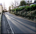
Up Goitre Coed Road, Quakers Yard
Goitre Coed Road ascends from the corner of Rodericks Terrace.
Image: © Jaggery
Taken: 30 Jan 2016
0.03 miles


