IMAGES TAKEN NEAR TO
Brecon Walk, TREHARRIS, CF46 5AJ
Introduction
This page details the photographs taken nearby to Brecon Walk, CF46 5AJ by members of the Geograph project.
The Geograph project started in 2005 with the aim of publishing, organising and preserving representative images for every square kilometre of Great Britain, Ireland and the Isle of Man.

There are currently over 7.5m images from over14,400 individuals and you can help contribute to the project by visiting https://www.geograph.org.uk
Image Map
Images are licensed for reuse under creativecommons.org/licenses/by-sa/2.0
Notes
- Clicking on the map will re-center to the selected point.
- The higher the marker number, the further away the image location is from the centre of the postcode.
Image Listing (111 Images Found)
Images are licensed for reuse under creativecommons.org/licenses/by-sa/2.0
Image
Details
Distance
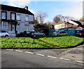
1
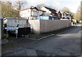
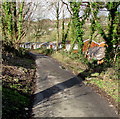
Brecon Walk, Quakers Yard
Cul-de-sac viewed from the corner of Tram Road Side.
Image: © Jaggery
Taken: 30 Jan 2016
0.01 miles
2
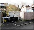
Brecon Walk electricity substation, Quakers Yard
Located here https://www.geograph.org.uk/photo/5864569 the cabinet is Western Power Distribution electricity substation S/S 551861.
Image: © Jaggery
Taken: 30 Jan 2016
0.02 miles
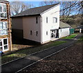
3
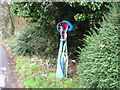
Quakers Yard name sign, Tram Road Side, Quakers Yard
The information board on the left records that this area near the confluence of two rivers, the Taff and the Bargoed Taff, was originally known as Rhyd y Grug, Welsh for Ford of the Rustling Waters. The name changed in the 18th century when a small plot of land was bequeathed to the Quaker movement for use as a Quaker burial ground or yard.
Image: © Jaggery
Taken: 30 Jan 2016
0.02 miles
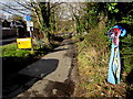
4
Cafe this way, Quakers Yard
The sign points along a path between Brecon Walk (on the left) and Tram Road Side.
Image: © Jaggery
Taken: 30 Jan 2016
0.02 miles
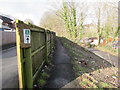
5
Tram Road Side, Quakers Yard
Looking to the NNW along Tram Road Side from near the Brecon Walk junction.
Image: © Jaggery
Taken: 30 Jan 2016
0.03 miles
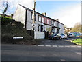
7
Taff Trail passing houses in Edwardsville
Image: © David Smith
Taken: 17 Sep 2022
0.03 miles
8
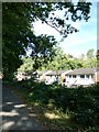
Row of houses, Quakers Yard
On the north side of Goitre Coed Road, opposite Rodericks Terrace.
Image: © Jaggery
Taken: 30 Jan 2016
0.03 miles
9
Taff Trail signpost, Quakers Yard
Following the course of the River Taff, the Taff Trail is a walking and cycling route in Wales, extending for about 88km (55 miles) between Brecon and Cardiff Bay. Here, the River Taff is 100 metres behind the camera.
Image: © Jaggery
Taken: 30 Jan 2016
0.05 miles
10
Fir Tree Centre, Quakers Yard
Community centre & cafe in Fir Tree Drive.
Image: © Jaggery
Taken: 30 Jan 2016
0.05 miles