1
Glancynon electricity substation, Abercynon
Viewed across Alexandra Road. The Western Power Distribution electricity
substation its located near Abertaf Villas. Its identifier is GLANCYNON S/S 551913.
http://www.geograph.org.uk/photo/4810580 to a view over the perimeter wall.
Image: © Jaggery
Taken: 30 Jan 2016
0.00 miles
2
Inside Glancynon electricity substation, Abercynon
Viewed over the perimeter wall next to the dark green gates here. http://www.geograph.org.uk/photo/4810576
Image: © Jaggery
Taken: 30 Jan 2016
0.00 miles
3
Alexandra Road towards St Gwynno's Church, Abercynon
The church http://www.geograph.org.uk/photo/4810538 is in the background on the left.
Image: © Jaggery
Taken: 30 Jan 2016
0.01 miles
4
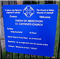
St Gwynno's Church nameboard, Abercynon
Located here. http://www.geograph.org.uk/photo/4810538
Image: © Jaggery
Taken: 30 Jan 2016
0.01 miles
5
RCT Homes Customer Service van in Alexandra Road, Abercynon
RCT Homes (Rhondda Cynon Taff Homes) was established in 2007 after thousands of tenants voted to transfer the ownership and management of their homes from Rhondda Cynon Taff Council. RCT Homes was set up as the first community mutual housing organisation in Wales, promoted by the Welsh Assembly Government to produce community-owned-and-controlled housing. Tenants take an active role in decision making and sit on the RCT Homes Board, having a key role in the awarding of multi-million pound contracts.
Image: © Jaggery
Taken: 30 Jan 2016
0.01 miles
6
St Gwynno's Church, Abercynon
Viewed across Alexandra Road. St Gwynno's Church is part of the Parish of Abercynon in the Church in Wales Diocese of Llandaff. The Church in Wales website states that the Parish of Abercynon with a population of c5,000 inhabitants is a former mining community situated at the southern end of the Cynon Valley Deanery c18 miles north of Cardiff. Though the village has an industrial history, the surrounding area is primarily rural.
The Parish Church of Saint Donat was built in 1898 at the southern end of the Parish. In 1904 the much smaller Church of Saint Gwynno, seen here, was established to serve the northern side of the valley.
Gwynno, or Gwynnog ab Gildas, was a 6th century Welsh saint.
Image: © Jaggery
Taken: 30 Jan 2016
0.02 miles
7
Osprey Club Room, Abercynon
This former chapel vestry in Glancynon Terrace has been the weekly
meeting place for the Osprey Fly Fishers Association since 1982.
Image: © Jaggery
Taken: 10 Aug 2012
0.03 miles
8
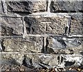
Ordnance Survey Cut Mark
This OS cut mark can be found on the NE parapet of the railway bridge. It marks a point 102.632m above mean sea level.
Image: © Adrian Dust
Taken: 7 Oct 2018
0.04 miles
9
Junction of Alexandra Road and Glancynon Terrace, Abercynon
Glancynon Terrace is on the right. The broken white lines in the lower left corner are at the Argyle Street junction.
Image: © Jaggery
Taken: 6 Feb 2019
0.04 miles
10
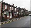
Row of stone houses, Glancynon Terrace, Abercynon
On the ascent towards Greenfield Terrace.
Image: © Jaggery
Taken: 6 Feb 2019
0.04 miles


